Ragnarok of the Big Trees

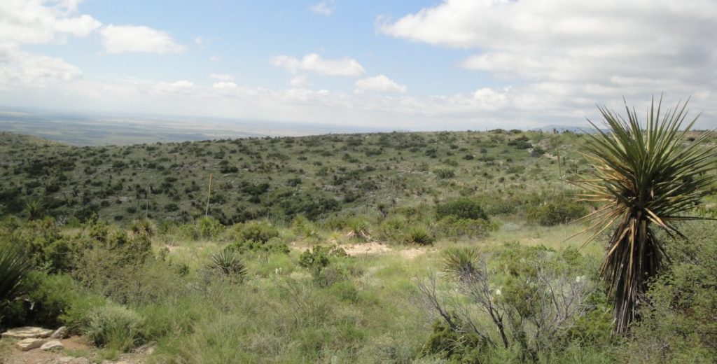
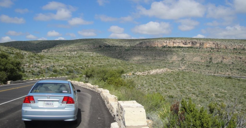
The Texas hill country is extraordinarily pleasant and we got a very green period because of lots of rain in the last couple of weeks. But my joy at encountering this beautiful landscape was tempered by oak wilt that has been killing the wonderful live oaks that give the hills their dominant feel. Oak wilt was identified in Wisconsin in the 1940s and has gradually been spreading.  It is s fungal disease spread both by a beetle and through natural root grafts among the oak trees.  So if one oak tree get the disease, it usually spreads to the neighbors.  I knew about oak wilt before, but seeing it in action here made me profoundly sad.  It seems to have had a bigger effect here in the Texas hill country than elsewhere, maybe because the live oaks form pure stands giving the beetles and the root grafts an easy way to go. 

You manage oak wilt, but it can be trouble. You have to be sure that the oaks have not sustained injuries that can attract the beetles or give the fungus spores an opening. The danger time for this is in the spring, until about July when summer heat kills exposed spores. This means that spring pruning of oaks is out.  You also have to be careful not to smack into the oaks with lawnmowers or other equipment.  If you have an infected oak, you have to get rid of it quick AND made sure the roots are not passing the fungus.  This means trenching between the infected oak and any others nearby.

When planting trees, it is a good idea not to create pure stands.  If oak trees are separated by other sorts of trees, the beetles and spores will spread more slowly or not at all.

The USDA page on oak wilt is here.

As long as I am feeling bad about the ragnarok of beloved big trees, I am also very upset by the emerald ash borer.  This rotten little bug is a native of Asia, first identified in Michigan in 2002.  Since then it has killed millions of ash trees and spread as south as Virginia, east to the Atlantic Ocean and west to the Great Plains.  The insect gets under the bark and quickly kills ash trees.

Emerald ash borers are not very mobile and left on their own they would probably remain a local problem.  Unfortunately, they hitch rides with us when we drive and especially when we transport infected firewood.   Never move fresh firewood any farther than you can walk.

The other one that bothers me is the hemlock wooly agelgid. This is another Asian import that was first reported in America in 1924.  This bug threatens the continued existence of hemlocks in the U.S. outside protected gardens.  Treatments are available but many of our nicest hemlock forests are gone already.  Hemlocks occupied a particular ecological niche in that they can grow in very deep shade. They used to fill an important role as understory trees and in shading little streams and keeping water temperatures lower.  Their ghost forests cannot do this.

On the plus side, we have developed American elms that are resistant to blight. We have better science available all the time. Maybe we can stay ahead of the bugs, but it will be a lot of work.

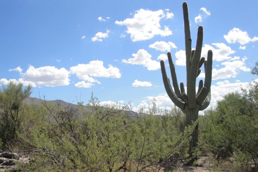
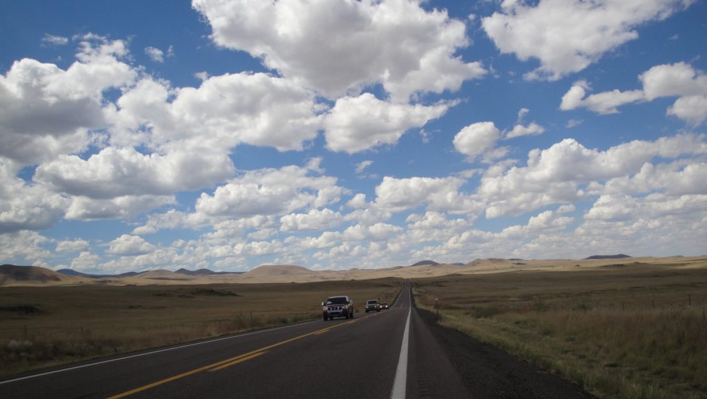
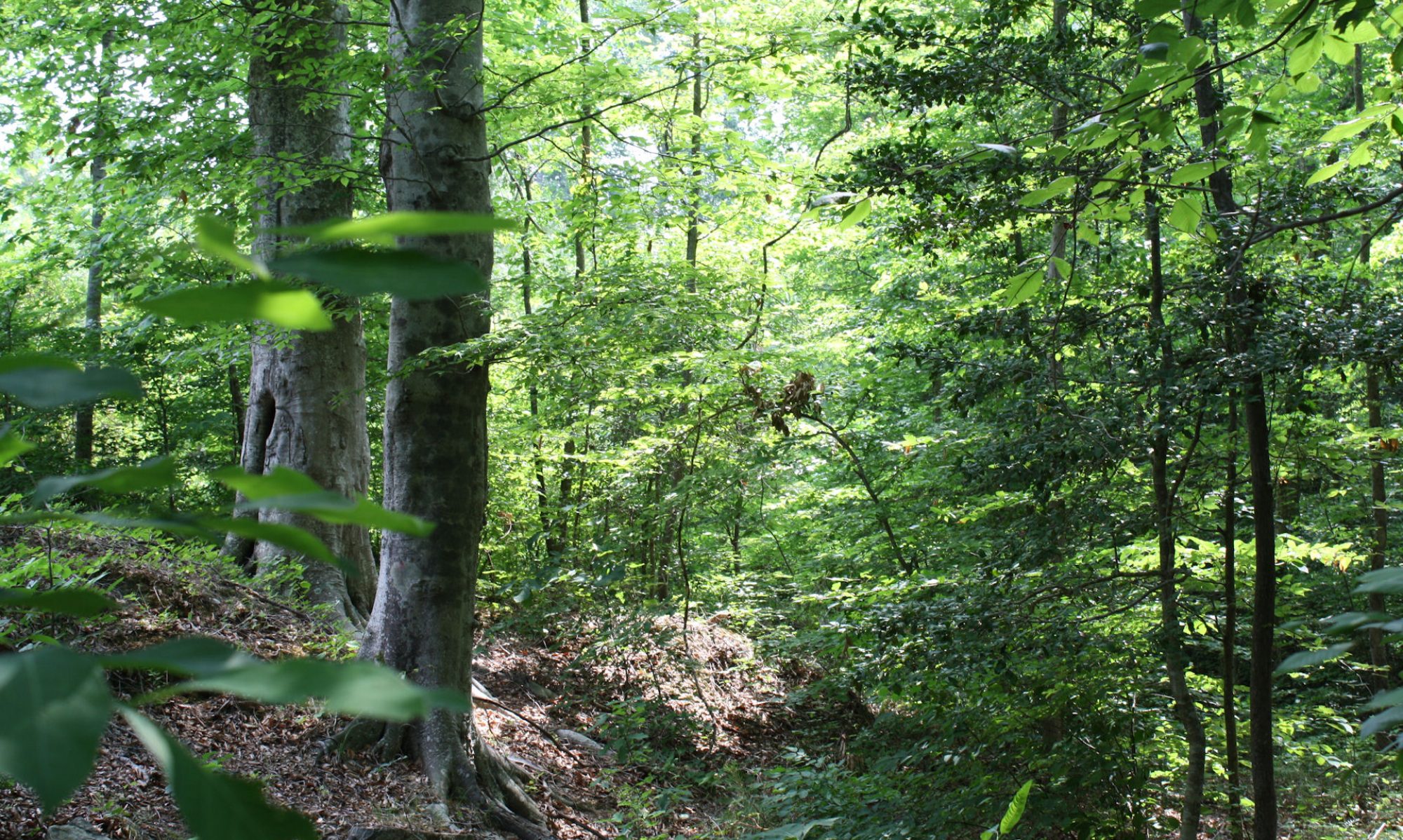
The top picture is a Texas hill country landscape.  You can see the dead trees in the foreground. Below that is what a healthy Texas live oak looks like. 

PS – I am informed that my reference to Ragnarok is too obscure and that some people might confuse it with some kind of video game. Ragnarok is from Norse mythology. It is the final struggle where the gods, such as Odin and Thor, are doomed. In German it is (also obscure) Gotterdamerung. A Wagner opera has that title and goes into the subject. The English “Twilight of the Gods” doesn’t really cover it, IMO. I understood when I wrote that it was hyperbole, but it seems that hyperbole is not really out of place if you risk losing species of trees that have dominated our landscapes since the end of the last ice age. 

San Antonio & the River Walk

The thing I liked most about San Antonio’s Riverwalk was that it seemed very natural because of the very large trees, mostly bald cypress and Montezuma cypress, and the lush plants along the route. Chrissy & I walked along the paths and then took the boat ride. The boat ride is worth it. The city is named after the San Antonio River, not the other way around.

Part of the river is natural, i.e. it has a mud bottom and part is created with a concrete channel. The river was a center of city life since the founding of the city, but the River Walk has been developing in something recognizable as predecessor of today’s version since the 1940s. In order to make that possible, the river needed to be controlled. San Antonio can get heavy rains and the river used to flood. Today the big investments along the river walk are protected by a flood gate system, which shunts flood waters into holding basins and an underground channel.

The climate and vegetation surprised me. It is more southern and Gulf shore-like than I thought. I always pictured the place as a more Western place, in the sense of drier or more of a prairie ecosystem. But there were palm trees, live oak, tropical looking rubber trees and the cypress I mentioned above all growing in enthusiastic profusion.  

I suppose that most people are less passionate about environment & trees and more about the many nice restaurants. It is very much alive with people, probably mostly tourists. We had lunch at a place called “Dick’s” where the waiters are encouraged to be wiseasses. That gives the place a special character. The food is just okay. In the evening we had some good steaks at the Texas Land & Steak restaurant.

Another surprising aspect of San Antonio is its Middle American feel. I expected the city to be a lot more Hispanic than it is. Maybe I was just in a particular part of town, but besides the sub-tropical plants and the Alamo, this place could have been in Ohio or Illinois.  In fact, what I have been noticing generally in my drive across America has been how American the country is. We talk a lot about our differences, but they pale before the things we have in common.

People have local pride, of course, and Texas has more local pride than any other place I went.  From my hotel window I saw Texas flags on top of many buildings. There are lots of other signs of Texas pride.  Even the waffle at our hotel was shaped like the State of Texas.

The top picture is the San Antonio River Walk. They put food coloring in to give it that green color. The next shows one of the many foot bridges over the river. The trees that are shaped like elm trees are actually Montezuma cypresses. There is an individual picture of one along side. Between that is a live oak. And at the bottom are the Texas waffle and flags.  Below is the Buckhorn Saloon, full of stuffed animals of the kind PETA doesn’t approve. There are even more in the rooms above.

Remembering the Alamo

We all know the stories of the Alamo. I say stories,plural, since there are lots of legends. Ever since I watched Davy Crockett when I was a little kid, I have enjoyed movies about the Alamo.The most elaborate was the one made by John Wayne, but I also recall a made for TV version with James Arness that was pretty good. The most recent one featured Billy-Bob Thornton as Davy Crockett. I have also seen dozens of documentaries and related programs. It is a big part of our historical memory. The legend has changed to accommodate changing sensibilities.  

No matter how you interpret or reinterpret it, however, the Alamo remains a story of heroism, sacrifice and bravery. The fewer than 200 volunteers who held the Alamo against more than the more than 3000 soldiers of the tyrant Santa Anna knew that they were facing steep odds & would have little or no chance of surviving the encounter.

Santa Anna seized power in Mexico City, abolished the constitution of 1824 and set about centralizing power in his own hands. Several states rebelled and Santa Anna put them down. The most distant was the rebellion in Texas. Santa Anna was a megalomaniac and he didn’t think he would have too much trouble dealing with the ragged and disorganized Texans. He came north himself with his and was impatient with the defenders of the Alamo, which helped build the legend. Instead of waiting for his big artillery to arrive, which could have reduced the Alamo to rubble w/o much loss of life among his own troops, Santa Anna ordered a frontal assault.  When some of his subordinates objected to the unnecessary loss of life, he reportedly compared his soldiers to chickens. It was their duty to die for him and he didn’t think the cost in their lives was not too much to pay for his glory. By giving the Texans a fighting chance he ensured a fight to be remembered.

It is interesting to think about how different history could have been with a few different decisions, and with a few people present or not. In this respect I am not thinking so much about the heroes of the Alamo but about Santa Anna. The Mexican constitution of 1824 was a good one.  It provided for more liberty and a more decentralized system. Santa Anna seized power and centralized the state in the same way that created problems in Latin societies throughout the 19th & 20th Centuries. Retaining the constitution of 1824 may or may not have prevented the succession of Texas, but imagine a century and a half of Mexican history with a more stable and liberal society and constitution. How different could have been the history of all North America.

The Alamo is smaller than it seems in the movies, which is no surprise since much of the battlefield is now occupied by various San Antonio buildings, including the hotel where we are staying.  It is also true that we just expect things that were important in history to be big.  The battle of the Alamo was not physically big compared with fights we saw in later history and not too much later in our own Civil War.  But the relatively small number of participants is one of the things that makes the Alamo so memorable.  We can know the participants as individuals. I am no expert on this and yet I can name several of the defenders and I know their stories, at least their legends. I suspect this is fairly common knowledge. I looked at the wall listing all their names. I could quickly read through the list from A-Z, along with where they came from.  This makes the history personal.

The pictures show the Alamo at night and the grounds.  The middle picture is a very nice live oak. The bottom picture is a Japanese monument to the heroes of the Alamo.  It goes to show the fame of the place and I thought it was a very good example of public diplomacy on the part of the Japanese to associate themselves with such a Texan and American symbol. 

750 Feet Under Ground

I knew Carlsbad Caverns well from looking at the old View Masters, as I wrote yesterday.  Their photos were/are better than mine.  They made the place look familiar.  The same was true when I first saw the Grand Canyon and Yosemite.  The good thing about the View Master was that we didn’t have very many slides and there was not as much competition from other things to watch or do.  I watched them over and over so I got to know all the pictures very well.

Nothing has changed in the Caverns since the View Master took the pictures fifty years ago.   Nothing much has changed for thousands or maybe millions of years.  Change is slow down here, 750 feet below the surface.  Water drips slowly and makes the rock formations you see in the pictures.  The little lumps on the formations are called “popcorn.”  They are formed by moisture from the air, which carries enough mineral that – with the many millennia – rock forms.  The rock down here is mostly limestone, the remains of the ancient sea I talked about in the previous post.

Unlike most caves, Carlsbad Caverns was not formed by flowing water like a stream.   Instead, water drained slowly from the caverns when the climate was wetter.  The “decorations” were created by the slow dripping.  The water carries carbonic acid, the same stuff in Coca-Cola.  It is a very weak acid, but it is enough to dissolve stone over long time.

The ranger explained all the above.  Carlsbad is not the biggest cavern in the U.S. but it is among the most interesting because of its unique characteristics or not being formed by flowing streams. This gives it lots of big and little rooms.  Caves formed by flowing streams usually are smoother and more uniform in the size of the rooms or chambers.  

They turned off all the lights during the program to show what a cave looks like in its normal state.  There is no way your eyes can adjust to zero light and all the wonders in stone are invisible.  In a very obvious way the cave we see is created by light we bring.  Someone asked about using color lights.  That may seen a little Disney-like, but the whole thing is a artistic creation of the light. The placement of the lights creates the reality.   The “natural” condition is pitch blackness.

There is no way I can get my brain around those millions of years and minute changes that lead to big things.  I noticed drops of water on the ends of some of the stalactites.  They weren’t dripping off and I don’t think they were going to drip off any time soon.  It will set there forming new rock formations.

Above is one of the formations. Chrissy said it looked like Gaudi architecture in Barcelona.  Below is the “lake” in the cave.  It is about the size of a jacuzzi.  It took thousands of years to fill to that depth.This is the place I remember best from the View Master. Something about the clear water stuck in my memory. The stone waterfall also makes an impression.

The Bottom of an Ancient Sea

We went down to Carlsbad Caverns.  This is another familiar place I visited for the first time.  I really saw a lot of the world – in 3D – with View Master.

I will post some actual cave pictures in the next entry.  I was also interested in the geography up top. There has been a fair amount of rain, so the landscape is unusually green. But this is generally a high and dry landscape with an interesting geology.  This used to sit at the bottom of a shallow ocean during the Permian Period. It was something like the Persian Gulf is today, very hot and dry on the land, but the undersea environment was very diverse.  This was a reef that supported all sorts of life.  Some, like sponges and algae, are familiar today.  Then there were the trilobites, my personal favorite. 

Lots of the animals, whole families of them, are extinct, since the Permian Period ended with the greatest mass-extinction of all time, wiping out the majority of earth’s species.  The Permian Period was the last period of the Paleozoic Era.  What followed was the Mesozoic, the age of dinosaurs.

The first two pictures are up top of Carlsbad Caverns in New Mexico. The bottom picture is alone I-10 in Texas.  Notice the rainbow. 

Deserts & High Chaparel

We drove south to Tucson and then east through the Sonora Desert.  The Sonora is the desert we all think of as THE desert.  It is the hottest of our American deserts, the one with all the cactuses that we know so well from the western movies.  We visited my cousin Elise and her husband Carl who live near Tucson.  I wrote re that last year here and here. The Tucson area is higher, greener and cooler than Phoenix, although both are in the same biome.

On the side is me with my new hat (purchased in Texas) in the desert. The hat is made of palm leaf and it really does keep the sun off and the head cool.  I like it.  

Just outside Tucson is the Saguaro National Park, where I took the pictures of the Sonora Desert vistas.  The saguaro cactus is the one with the arms that looks like a man flexing his muscles.  It takes many years for them to grow big enough to get arms.  You can tell you are in the Sonora when you see the saguaro, which grow naturally nowhere else.

Above and below are Sonora landscapes

Below – the flat area behind the sign is – believe it or not – the continental divide.  At some point out in that field, if you peed some would go toward the Pacific and some toward the Atlantic. We are actually at a fairly high elevation.  It is just a flat plateau.  I don’t know how exactly they can tell which way the water would flow. I always thought of the continental divide as a sort of ridge. 

North and west of the Sonora is the Mojave Desert, which I wrote about last April, with its characteristic brush and Joshua Trees.   You hit the Chihuahua Desert as you go east.  It is not true that the Taco Bell dog’s wild ancestors roamed this region.  The Chihuahua desert is theoretically less harsh, but it seems to have a little less interesting life.  I guess that the Sonora is very harsh, but fairly consistent, which allows varied life forms to develop.

Ancient Hunters, Modern Controversy

Between Clovis and Portales, New Mexico is the Blackwater Draw archeological site and museum.  It was closed, but the old guy running the place let me in anyway and we talked about archeology.  This is the place where they found the “Clovis Points,” a particular type of spear point used by the people who lived around here 13000 years ago.  They didn’t have bows and arrows.  Those came only around 3000 years ago.  Instead they used spear throwing sticks – an atlatl.  The stick essentially extends the arm and gives a man leverage to throw harder and farther than he could with just his muscle alone.
It gave our prehistoric ancestors enough firepower to drive the North American megafauna – mammoths, giant sloths, cave bears, saber tooth tigers etc – into extinction.

There is a lot of controversy about the Clovis people.  Nobody knows what they were like, since no human remains have been found.  Scientists used to just assume that they were ancestors of today’s Native Americans, but recent archeological discoveries, such as the Kennewick man (who looked a lot like Jean-Luc Picard), have called some of that into question.   

What happened in America 13000 years ago – before anybody around today was here – is a bigger issue today than you might think.  Some Native American creation myths hold that their people were original to the area or even sprung from the earth. Scientific evidence to the contrary bothers some people. Some have even gone so far as to essentially try to destroy evidence, or at least prevent its study. It is really a species of racism.

It strains credulity to believe that they particular native people inhabiting this place a hundred years ago were the same ones living here 12000 years ago. Linguistic and historical evidence alone would preclude that.  But evidently creationism dies hard no matter where it is rooted. And sometimes political correctness demands that we pretend to believe the believers.

I have a simple view of history. After around a century, when events have passed from living memory, ALL human achievement becomes the common heritage of all humans. In other words, we cannot take special credit or blame for anything that nobody alive actually remembers. I studied and appreciated ancient Greeks and Romans, despite probably being more related genetically to the barbarians that destroyed their civilization. It is great when someone from China can claim inspiration from Thomas Jefferson as I may from Lao Tzu. The Clovis people were our human ancestors. It really doesn’t matter who can or cannot make a silly claim to being genetically more similar.

Land of Enchantment — Too

More pictures and comments. The geography becomes more pretty and varied as you climb out of the high plains into the foothills and mountains. Below are more pictures from the plateaus and coming down the other side in the Salt River Canyon of Arizona. Some of the pictures are fairly high resolution, so if you want to see details, click on them and enlarge.

Above is Hondo, NM. There is not much besides a gas station, but it seems very pleasant. Below is probably somebody’s hobby: part of a herd of longhorn cattle.

Below is the place were the original Smokey Bear was rescued from a forest fire. They have a marker and a bigger Smokey to show the place. 

Below is heavy traffic on US 60

Below are views of the Salt River Canyon, as you come off the mountains into the Sonora Desert.  Building the road must have been a heroic venture.

From the other side.

Road

Land of Enchantment

The New Mexico board of tourism calls their state the “Land of Enchantment” and they are right.  As you drive across the middle of the state, you encounter a wide variety of beautiful ecosystems, lots of cute towns and great vistas.  I drove along US Highways 70 and 60 and avoided the Interstate. Below are some pictures and comments.

Above and below are examples of the changing biomes  that sometimes sit within a few minutes drive of each other.  Above are ponderosa pine.  The open park-like terrains is naturally kept that way by frequent small fires. The ponderosa pines are fire-dependent.  The young trees have black bark; as they get older -at around 100 years – the bark turns reddish.  Ponderosa pines have a distinctive smell and you could tell you were near them with your eyes closed. I stopped at the roadside where I took the picture to experience that. Below is a mixed juniper and pinyon pine landscape.  It is a bit drier than the ponderosa places.  Pinyon pines produce “pine nut” consumed by local people and wildlife.

Below – as you get into drier places, the trees disappear and you get various types of grassland.  I am less familiar with the specifics of those biomes. 

Below is almost entirely grass. The modern things you see are the “very large array,” a series of radio telescopes used to explore the far reaches of the cosmos, from the far reaches of New Mexico.  I guess that the elevation and clear air make that easier.

Below are lava bed. According to what I read, the lava oozed out around 800 years ago.  Some plants have since colonized.  It must have been nearly impassible on foot or in a wagon when people first found them. 

Dirt is the Basis of Civilization

I needed to get maximize my daylight so I left Portales just before the sun came up and for about an hour and a half I drove through some of the most monotonous landscape possible, sometimes made less appealing by the early morning gloom, I suppose. Sometimes there was little evidence of active human occupation.   At other times you could see where people had moved away. 

US Highway 60 runs through what was the edge of the Dust Bowl in the 1930s.  The countryside had a denser population back then than it does now. This is a good thing.  The land here gets irregular rainfall.  In some years there is enough to temp people to plow up the sod and plant row crops. That is what happened right after World War I, when this area was booming with high war-time prices for wheat and other crops.   A vicious cycle set in when prices came down off their highs.  Farmers needed to plow up more grassland and grow more crops to make the same money, which they often needed to pay off their mortgages and the equipment they invested in during the boom time.

An agricultural method had been developed in the humid Eastern U.S., where rain is more consistent and where the wind doesn’t blow so hard or steadily.   Something you notice even on a short trip is that the wind is persistent as a toothache out here.  

The grass and prairie vegetation had protected the soils from the wind for around ten thousand years, ever since the warming following the last ice age.  Prairie vegetation is adapted to the wet-dry cycles of nature and to the wind and fire that is endemic to the high plains.  Most of the plants are perennial. They send down deep and interwoven roots.  When the dry weather comes, these roots sustain the plants and hold the dirt. 

The grassland ecosystem had created deep and rich soil over the course of literally thousands of years.  During the wet decade following World War I, farmers essentially mined and used up this soil in an unsustainable way.  They didn’t understand it and some thought the rain was natural or permanent.   Many were probably surprised that nobody had discovered the bounty of the land before.  The hotter-drier cycle set in again in the 1930s.  Soil, exposed to the wind by plowing and harvesting just blew away, leaving some farms almost bare of topsoil and other buried in the stuff.  This was the environment when thousands of refugees headed out.  You read about that in John Steinbeck’s “Grapes of Wrath” or in a more recent non-fiction book called “The Worst Hard Time.” (I studied the dust bowl years when I was going to Iraq, since the dust storms there are also partially man-made catastrophes.  It formed the basis of some of my slow-moving but grandious dreams)

We take better care of the soil today.  During the 1930s farmers and government folks (like the CCC) planted windbreaks of trees. FDR had a special fondness for tree-planting. Of all his great and not so great traits, that is the one I find personally most appealing.  Farmers now use low-till or no-till methods that leave the soils more intact and leave cover vegetation on the surface during the off-seasons.  Years of experience has taught us that there are some grasslands that just cannot be made to produce any crops besides maybe hay and some that cannot-should not even do that.

An old farmer told me that this year was a good and a wet year on the high plains. He said that the crops, like the milo/giant sorghum were growing well and that the harvests were good.  But today we know that this wet year will sooner or later – probably sooner – be followed by some dry ones.  And we know that we need to keep and protect the environment for those times.  Dirt is the basis of civilization and if you don’t care for the soil, there really is nothing left for you.

The picture up top in along US 60 in Western NM.  The one below is up the hills a bit in the more central part of the state. The bottom picture explains itself.