« August 2010 | Main | October 2010 »
September 30, 2010
Local Heroes in Western Tennessee

We spent last night at the Holiday Inn in Forrest City, Arkansas. The town was named for Nathan Bedford Forrest. As we drove through western Tennessee, we came across Forrest a few more times. He was very much the famous home town boy. I read that there are thirty-two monuments associated with him in Tennessee. Nathan Bedford Forrest was a Confederate cavalry officer and a true military genius. On the other hand, he trafficked in slaves, was accused of war crimes and was associated with the KKK, although he denied both of the latter. On the other hand, in later life Forrest advocated re-consolidation between North and South and between the races.

The man was a fighter and good at his job. He famously said that war means fighting and fighting means killing. What you can say for sure about Nathan Bedford Forrest is that he was a man of significant contradictions and that he was well-thought-of at least by some people around Western Tennessee, Western Arkansas & Northern Mississippi.

A less controversial local hero is Casey Jones. He was an engineer on the Illinois Central Railroad. His passenger train, the Cannonball Express, ran into a stalled freight train near Vaughan, MS. Jones stayed with the train, pulling on the brakes.He managed to reduce the speed of his train from around 75mph to 35mph.His bravery undoubtedly saved the lives of passengers, none of whom were killed, but Casey Jones died in the wreck.

Casey Jones’ experience was immortalized in a song, much like the Wreck of the Old 97, in Virginia. Train wrecks made an impression on those around to see them. We visited the Casey Jones museum in Jackson, Tennessee and saw his house, some railroad artifacts & an engine much like his. It is one of those places that is worth seeing if you are already driving past, but probably not worth going to see if you are not.
The lyrics to the song are at this link.
The top picture is a cotton field in Western Tennessee. Cotton is very hard on the soil & the crop exhausts the nutrients quickly. This was wasteful but it also provided incentive for westward expansion, as new lands were constantly needed. Next is the pyramid of Memphis. I guess it is an arena. Chrissy took the picture of the pyramid, as we drove over the bridge and she demanded I give her credit. This was indeed a good picture, but the others she took on the fly look like they were taken by a drunken monkey. We have to take the sweet with the bitter. BTW – there are no pyramids in the original Memphis. The next picture is an engine like the machine that Casey Jones would have driven, but this one is smaller. The bottom picture is the bathroom in Casey Jones’ house. He was fairly well off for the time. I would like to visit the past, but I wouldn’t want to live there. Besides all the exotic diseases, poor dentistry and interesting smells, we had bathrooms like this for those lucky enough to have such luxurious accommodations.
September 29, 2010
Waiting at the Bat Cave

We went to an old railroad tunnel near Fredericksburg to see the bats emerge. You can see from the picture above that bat viewing is a minor local attraction.We didn’t actually see the bats emerge.They did it too much after dark.They come out around dark every night.If they come out around dark before it gets too dark, you can see them, otherwise we just take their word that they came out.
The bats in the tunnel are Mexican free tail bats.They are small bats that eat insects, mostly moths. They are useful because they devour prodigious numbers of corn moths.

We were told, but I didn’t actually see, that the bats take off in a spiral to get enough lift to get into the air. The experienced bats do it well. When there are lots of new bats, the show is evidently more chaotic, presuming you can see it. The bats never come out on schedule and nobody is sure why they come out when they do. One theory is that they just come out when they get hungry, so it depends on how much they ate the night before. Another theory is that there is not theory. One or more of them wanders out and others follow.
A couple people run the “bat watch”. Bat people are special and they are very enthusiastic about bats. They showed pictures and explained the importance of bats in the environment. As I wrote above, the most useful thing they do is eat lots of flying bugs.Bat guano makes very good fertilizer and the bat woman explained guano used to be one of Texas’ biggest exports.
Bats are threatened by a fungus disease called white nose. It can wipe out whole bat colonies. Nobody knows what causes it, but it is probably helped to spread by people coming around from cave to cave, so many bat caves are now closed off to casual visitors.At out bat viewing area, we were told not to go down to the opening. I would not have done so anyway.I appreciate the importance of bats and understand that these little bats are harmless, but I still think it would be a little creepy to be standing right among them. Besides, they probably crap when they fly.
The top picture is the crowd waiting for the bats. Below that picture is one of my friend Dennis Neffendorf’s sheep just before sun up. Dennis owns a peach farm near Fredericksburg. If you want some great peaches, let me know and I will put you in touch. You met Dennis in earlier posts. He worked with me in Iraq. The sheep are unrelated to the bats, but I needed a place to put the nice picture.
President Johnson & his ranch
We also visited the LBJ ranch. Unfortunately, I deleted the pictures by mistake. My only text would be that LBJ actually cared about his ranch. He had a great herd of cattle and he took good care of the land. No matter what you think of him as a politician or a human being, he was a good steward of the land. For me, that means a lot.
Dennis, mentioned above, grew up near the Johnson ranch and as a kid got to do odd jobs around the ranch. He know a lot about the Johnson’s and the people around them. He said Johnson was a bigger than life type guy. He could be a bully and an A-hole, but he remembered his roots and took an interest in everyone he met. Like all great men, he was complex and contradictory, so biographers can find what they want. Lady-Bird Johnson was universally a lady in all the positive senses of the word and she stood by Lyndon. I took a good picture of the tombstones of Lydon and Lady-Bird. Hers is a little bigger. On his tombstone is the presidential seal. Hers features a Texas bluebell. Mrs. Johnson did a good job with wild flowers.
Deutschland uber Texas

You can see the physical German influence in the buildings and the people in Fredericksburg and all around the Texas hill country.I knew that lots of Germans colonized Texas, but I was surprised by how much this resembled Wisconsin in terms of heritage and appearance. My picture doesn’t really show it. I made a mistake and erased fifteen of my pictures, so I have to use what I have left. Along this street there are mostly German names. We had breakfast in a nice German bakery.

Germans were hard-working and frugal, which meant that they adapted fairly well almost wherever they went. We visited one of their neat farms – the Sauer-Beckmann farm – near the LBJ ranch. They have living history, with period costumes, appropriate livestock etc. The original colonists, the Sauer family, made a “modified” log cabin. I say modified because logs were relatively rare in this part of Texas centuries ago. (It is a little misleading to look around today because there are more trees today, since the wild fires started by lightning and Indians have been controlled.) To save on wood, the logs were interspersed with stones, which were common. Making a wall entirely of stone takes longer than making this kind of hybrid. When they had the time, they made the buildings out of limestone and so later additions were often stone.
The pictures above and below are from the Sauer-Beckmann farm, part of the LBJ park complex. One good thing about both is that they have actual livestock. Livestock were a big part of rural life and when they do the recreations w/o them it is not realistic. Johnson himself left some of his land to the park system with the stipulation that they maintain the place as a working ranch with cattle.

The Germans fit uneasily into the pre-Civil War Texas because they set themselves apart to some extent and had a superior attitude at times. More importantly, they were strongly and loudly against slavery. When Texas voted to succeed from the Union in 1861, the counties with heavy German populations voted to remain in the Union. Texas Confederates declared the hill country in rebellion – against the confederates. There were open battles between pro-union and Confederate forces. Scores of Germans were killed in the fighting, others were shot and hung. Lynching of Germans was practiced. These episodes of Civil War history are not well known. Germans being lynched, beaten and murdered because of their stand against slavery doesn’t seem to fit in well with subsequent narratives.
I have written before about Germans in the U.S. and recently about the Amana Colonies. We now have forgetting the contributions of America’s largest ethnic group because Germans and their contributions have become as American as hamburgers, hot dogs and good beer.
September 28, 2010
Ragnarok of the Big Trees

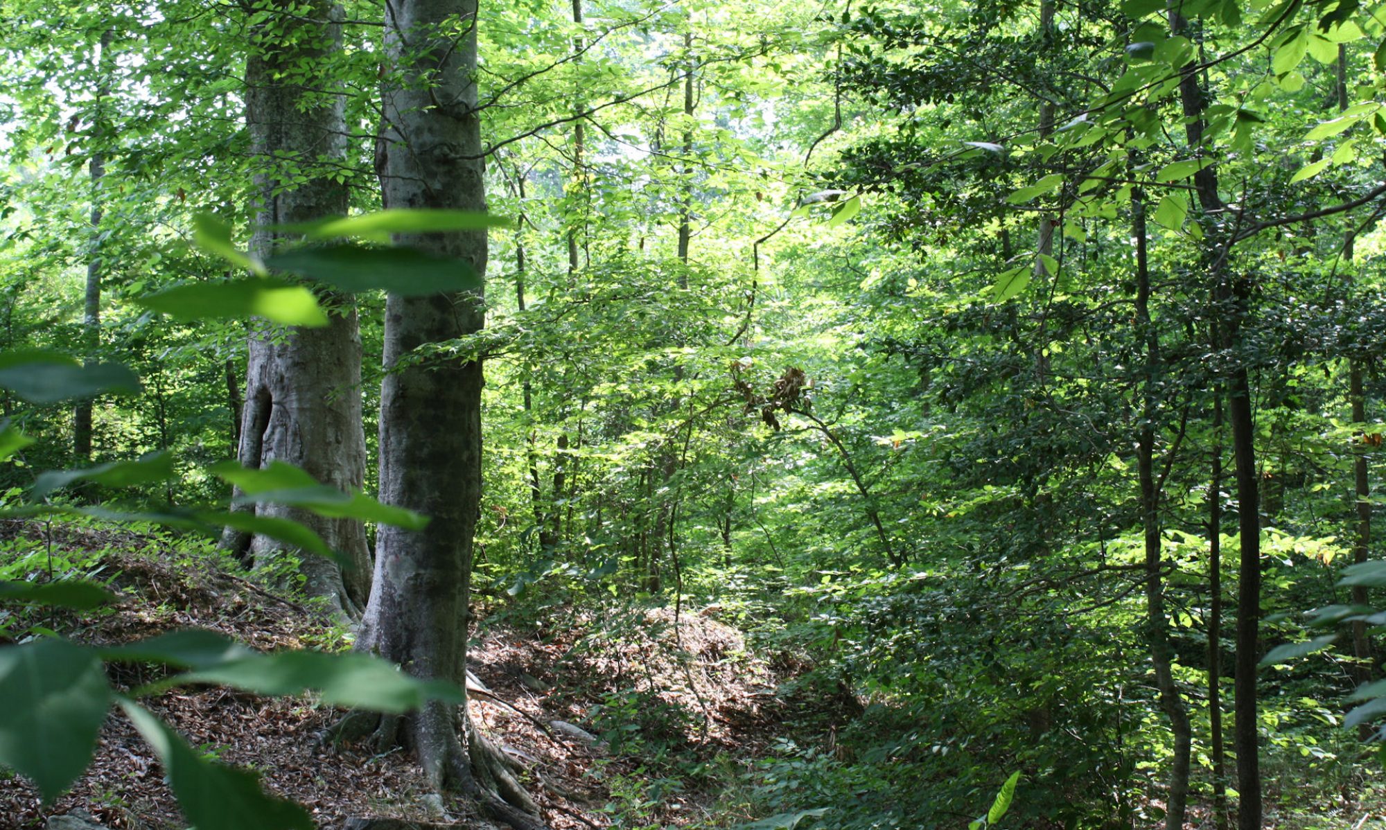
The Texas hill country is extraordinarily pleasant and we got a very green period because of lots of rain in the last couple of weeks.But my joy at encountering this beautiful landscape was tempered by oak wilt that has been killing the wonderful live oaks that give the hills their dominant feel.Oak wilt was identified in Wisconsin in the 1940s and has gradually been spreading. It is s fungal disease spread both by a beetle and through natural root grafts among the oak trees. So if one oak tree get the disease, it usually spreads to the neighbors. I knew about oak wilt before, but seeing it in action here made me profoundly sad. It seems to have had a bigger effect here in the Texas hill country than elsewhere, maybe because the live oaks form pure stands giving the beetles and the root grafts an easy way to go.

You manage oak wilt, but it can be trouble.You have to be sure that the oaks have not sustained injuries that can attract the beetles or give the fungus spores an opening. The danger time for this is in the spring, until about July when summer heat kills exposed spores.This means that spring pruning of oaks is out. You also have to be careful not to smack into the oaks with lawnmowers or other equipment. If you have an infected oak, you have to get rid of it quick AND made sure the roots are not passing the fungus. This means trenching between the infected oak and any others nearby.
When planting trees, it is a good idea not to create pure stands. If oak trees are separated by other sorts of trees, the beetles and spores will spread more slowly or not at all.
The USDA page on oak wilt is here.
As long as I am feeling bad about the ragnarok of beloved big trees, I am also very upset by the emerald ash borer. This rotten little bug is a native of Asia, first identified in Michigan in 2002. Since then it has killed millions of ash trees and spread as south as Virginia, east to the Atlantic Ocean and west to the Great Plains. The insect gets under the bark and quickly kills ash trees.
Emerald ash borers are not very mobile and left on their own they would probably remain a local problem. Unfortunately, they hitch rides with us when we drive and especially when we transport infected firewood. Never move fresh firewood any farther than you can walk.
The other one that bothers me is the hemlock wooly agelgid.This is another Asian import that was first reported in America in 1924. This bug threatens the continued existence of hemlocks in the U.S. outside protected gardens. Treatments are available but many of our nicest hemlock forests are gone already. Hemlocks occupied a particular ecological niche in that they can grow in very deep shade. They used to fill an important role as understory trees and in shading little streams and keeping water temperatures lower. Their ghost forests cannot do this.
On the plus side, we have developed American elms that are resistant to blight. We have better science available all the time. Maybe we can stay ahead of the bugs, but it will be a lot of work.
The top picture is a Texas hill country landscape. You can see the dead trees in the foreground. Below that is what a healthy Texas live oak looks like.
PS – I am informed that my reference to Ragnarok is too obscure and that some people might confuse it with some kind of video game. Ragnarok is from Norse mythology. It is the final struggle where the gods, such as Odin and Thor, are doomed. In German it is (also obscure) Gotterdamerung. A Wagner opera has that title and goes into the subject. The English “Twilight of the Gods” doesn’t really cover it, IMO. I understood when I wrote that it was hyperbole, but it seems that hyperbole is not really out of place if you risk losing species of trees that have dominated our landscapes since the end of the last ice age.
September 27, 2010
San Antonio & the River Walk

The thing I liked most about San Antonio’s Riverwalk was that it seemed very natural because of the very large trees, mostly bald cypress and Montezuma cypress, and the lush plants along the route.Chrissy & I walked along the paths and then took the boat ride.The boat ride is worth it. The city is named after the San Antonio River, not the other way around.

Part of the river is natural, i.e. it has a mud bottom and part is created with a concrete channel.The river was a center of city life since the founding of the city, but the River Walk has been developing in something recognizable as predecessor of today’s version since the 1940s.In order to make that possible, the river needed to be controlled.San Antonio can get heavy rains and the river used to flood. Today the big investments along the river walk are protected by a flood gate system, which shunts flood waters into holding basins and an underground channel.

 The climate and vegetation surprised me.It is more southern and Gulf shore-like than I thought.I always pictured the place as a more Western place, in the sense of drier or more of a prairie ecosystem. But there were palm trees, live oak, tropical looking rubber trees and the cypress I mentioned above all growing in enthusiastic profusion.
I suppose that most people are less passionate about environment & trees and more about the many nice restaurants.It is very much alive with people, probably mostly tourists. We had lunch at a place called “Dick’s” where the waiters are encouraged to be wiseasses. That gives the place a special character.The food is just okay.In the evening we had some good steaks at the Texas Land & Steak restaurant.
Another surprising aspect of San Antonio is its Middle American feel.I expected the city to be a lot more Hispanic than it is.Maybe I was just in a particular part of town, but besides the sub-tropical plants and the Alamo, this place could have been in Ohio or Illinois. In fact, what I have been noticing generally in my drive across America has been how American the country is. We talk a lot about our differences, but they pale before the things we have in common.

People have local pride, of course, and Texas has more local pride than any other place I went. From my hotel window I saw Texas flags on top of many buildings. There are lots of other signs of Texas pride. Even the waffle at our hotel was shaped like the State of Texas.

The top picture is the San Antonio River Walk. They put food coloring in to give it that green color. The next shows one of the many foot bridges over the river. The trees that are shaped like elm trees are actually Montezuma cypresses. There is an individual picture of one along side. Between that is a live oak. And at the bottom are the Texas waffle and flags. Below is the Buckhorn Saloon, full of stuffed animals of the kind PETA doesn’t approve. There are even more in the rooms above.

September 26, 2010
Remembering the Alamo

We all know the stories of the Alamo.I say stories,plural, since there are lots of legends.Ever since I watched Davy Crockett when I was a little kid, I have enjoyed movies about the Alamo.The most elaborate was the one made by John Wayne, but I also recall a made for TV version with James Arness that was pretty good. The most recent one featured Billy-Bob Thornton as Davy Crockett.I have also seen dozens of documentaries and related programs.It is a big part of our historical memory.The legend has changed to accommodate changing sensibilities.

No matter how you interpret or reinterpret it, however, the Alamo remains a story of heroism, sacrifice and bravery.The fewer than 200 volunteers who held the Alamo against more than the more than 3000 soldiers of the tyrant Santa Anna knew that they were facing steep odds & would have little or no chance of surviving the encounter.

Santa Anna seized power in Mexico City, abolished the constitution of 1824 and set about centralizing power in his own hands.Several states rebelled and Santa Anna put them down. The most distant was the rebellion in Texas.Santa Anna was a megalomaniac and he didn’t think he would have too much trouble dealing with the ragged and disorganized Texans.He came north himself with his and was impatient with the defenders of the Alamo, which helped build the legend.Instead of waiting for his big artillery to arrive, which could have reduced the Alamo to rubble w/o much loss of life among his own troops, Santa Anna ordered a frontal assault. When some of his subordinates objected to the unnecessary loss of life, he reportedly compared his soldiers to chickens.It was their duty to die for him and he didn’t think the cost in their lives was not too much to pay for his glory.By giving the Texans a fighting chance he ensured a fight to be remembered.
 It is interesting to think about how different history could have been with a few different decisions, and with a few people present or not.In this respect I am not thinking so much about the heroes of the Alamo but about Santa Anna. The Mexican constitution of 1824 was a good one. It provided for more liberty and a more decentralized system.Santa Anna seized power and centralized the state in the same way that created problems in Latin societies throughout the 19th & 20th Centuries.Retaining the constitution of 1824 may or may not have prevented the succession of Texas, but imagine a century and a half of Mexican history with a more stable and liberal society and constitution.How different could have been the history of all North America.
The Alamo is smaller than it seems in the movies, which is no surprise since much of the battlefield is now occupied by various San Antonio buildings, including the hotel where we are staying. It is also true that we just expect things that were important in history to be big. The battle of the Alamo was not physically big compared with fights we saw in later history and not too much later in our own Civil War. But the relatively small number of participants is one of the things that makes the Alamo so memorable. We can know the participants as individuals.I am no expert on this and yet I can name several of the defenders and I know their stories, at least their legends.I suspect this is fairly common knowledge. I looked at the wall listing all their names.I could quickly read through the list from A-Z, along with where they came from. This makes the history personal.
The pictures show the Alamo at night and the grounds. The middle picture is a very nice live oak. The bottom picture is a Japanese monument to the heroes of the Alamo. It goes to show the fame of the place and I thought it was a very good example of public diplomacy on the part of the Japanese to associate themselves with such a Texan and American symbol.
750 Feet Under Ground
I knew Carlsbad Caverns well from looking at the old View Masters, as I wrote yesterday. Their photos were/are better than mine. They made the place look familiar. The same was true when I first saw the Grand Canyon and Yosemite. The good thing about the View Master was that we didn’t have very many slides and there was not as much competition from other things to watch or do. I watched them over and over so I got to know all the pictures very well.

Nothing has changed in the Caverns since the View Master took the pictures fifty years ago. Nothing much has changed for thousands or maybe millions of years. Change is slow down here, 750 feet below the surface. Water drips slowly and makes the rock formations you see in the pictures. The little lumps on the formations are called “popcorn.” They are formed by moisture from the air, which carries enough mineral that – with the many millennia – rock forms. The rock down here is mostly limestone, the remains of the ancient sea I talked about in the previous post.

Unlike most caves, Carlsbad Caverns was not formed by flowing water like a stream. Instead, water drained slowly from the caverns when the climate was wetter. The “decorations” were created by the slow dripping. The water carries carbonic acid, the same stuff in Coca-Cola. It is a very weak acid, but it is enough to dissolve stone over long time.

The ranger explained all the above. Carlsbad is not the biggest cavern in the U.S. but it is among the most interesting because of its unique characteristics or not being formed by flowing streams. This gives it lots of big and little rooms. Caves formed by flowing streams usually are smoother and more uniform in the size of the rooms or chambers.

They turned off all the lights during the program to show what a cave looks like in its normal state. There is no way your eyes can adjust to zero light and all the wonders in stone are invisible. In a very obvious way the cave we see is created by light we bring. Someone asked about using color lights. That may seen a little Disney-like, but the whole thing is a artistic creation of the light. The placement of the lights creates the reality. The “natural” condition is pitch blackness.

There is no way I can get my brain around those millions of years and minute changes that lead to big things. I noticed drops of water on the ends of some of the stalactites. They weren’t dripping off and I don’t think they were going to drip off any time soon. It will set there forming new rock formations.
Above is one of the formations. Chrissy said it looked like Gaudi architecture in Barcelona. Below is the “lake” in the cave. It is about the size of a jacuzzi. It took thousands of years to fill to that depth.This is the place I remember best from the View Master. Something about the clear water stuck in my memory. The stone waterfall also makes an impression.

September 25, 2010
The Bottom of an Ancient Sea

We went down to Carlsbad Caverns. This is another familar place I visited for the first time. I really saw a lot of the world – in 3D – with View Master.

I will post some actual cave pictures in the next entry. I was also interested in the geography up top. There has been a fair amount of rain, so the landscape is unusually green. But this is generally a high and dry landscape with an interesting geology. This used to sit at the bottom of a shallow ocean during the Permian Period. It was something like the Persian Gulf is today, very hot and dry on the land, but the undersea environment was very diverse. This was a reef that supported all sorts of life. Some, like sponges and algae, are familiar today. Then there were the trilobites, my personal favorite.

Lots of the animals, whole families of them, are extinct, since the Permian Period ended with the greatest mass-extinction of all time, wiping out the majority of earth’s species. The Permian Period was the last period of the Paleozoic Era. What followed was the Mesozoic, the age of dinosaurs.
The first two pictures are up top of Carlsbad Caverns in New Mexico. The bottom picture is alone I-10 in Texas. Notice the rainbow.
September 24, 2010
Deserts & High Chaparel
 We drove south to Tucson and then east through the Sonora Desert. The Sonora is the desert we all think of as THE desert. It is the hottest of our American deserts, the one with all the cactuses that we know so well from the western movies. We visited my cousin Elise and her husband Carl who live near Tucson. I wrote re that last year here and here. The Tucson area is higher, greener and cooler than Phoenix, although both are in the same biome.
On the side is me with my new hat (purchased in Texas) in the desert. The hat is made of palm leaf and it really does keep the sun off and the head cool. I like it.
Just outside Tucson is the Saguaro National Park, where I took the pictures of the Sonora Desert vistas. The saguaro cactus is the one with the arms that looks like a man flexing his muscles. It takes many years for them to grow big enough to get arms. You can tell you are in the Sonora when you see the saguaro, which grow naturally nowhere else.
Above and below are Sonora landscapes

Below – the flat area behind the sign is – believe it or not – the continental divide. At some point out in that field, if you peed some would go toward the Pacific and some toward the Atlantic. We are actually at a fairly high elevation. It is just a flat plateau. I don’t know how exactly they can tell which way the water would flow. I always thought of the continental divide as a sort of ridge.

North and west of the Sonora is the Mojave Desert, which I wrote about last April, with its characteristic brush and Joshua Trees. You hit the Chihuahua Desert as you go east. It is not true that the Taco Bell dog’s wild ancestors roamed this region. The Chihuahua desert is theoretically less harsh, but it seems to have a little less interesting life. I guess that the Sonora is very harsh, but fairly consistent, which allows varied life forms to develop.
September 23, 2010
Ancient Hunters, Modern Controversy

Between Clovis and Portales, New Mexico is the Blackwater Draw archeological site and museum. It was closed, but the old guy running the place let me in anyway and we talked about archeology. This is the place where they found the “Clovis Points,” a particular type of spear point used by the people who lived around here 13000 years ago. They didn’t have bows and arrows. Those came only around 3000 years ago. Instead they used spear throwing sticks – an atlatl. The stick essentially extends the arm and gives a man leverage to throw harder and farther than he could with just his muscle alone.
It gave our prehistoric ancestors enough firepower to drive the North American megafauna – mammoths, giant sloths, cave bears, saber tooth tigers etc – into extinction.
There is a lot of controversy about the Clovis people. Nobody knows what they were like, since no human remains have been found. Scientists used to just assume that they were ancestors of today’s Native Americans, but recent archeological discoveries, such as the Kennewick man (who looked a lot like Jean-Luc Picard), have called some of that into question.
What happened in America 13000 years ago – before anybody around today was here – is a bigger issue today than you might think. Some Native American creation myths hold that their people were original to the area or even sprung from the earth. Scientific evidence to the contrary bothers some people. Some have even gone so far as to essentially try to destroy evidence, or at least prevent its study. It is really a species of racism.
It strains credulity to believe that they particular native people inhabiting this place a hundred years ago were the same ones living here 12000 years ago. Linguistic and historical evidence alone would preclude that. But evidently creationism dies hard no matter where it is rooted. And sometimes political correctness demands that we pretend to believe the believers.
I have a simple view of history. After around a century, when events have passed from living memory, ALL human achievement becomes the common heritage of all humans. In other words, we cannot take special credit or blame for anything that nobody alive actually remembers. I studied and appreciated ancient Greeks and Romans, despite probably being more related genetically to the barbarians that destroyed their civilization. It is great when someone from China can claim inspiration from Thomas Jefferson as I may from Lao Tzu. The Clovis people were our human ancestors. It really doesn’t matter who can or cannot make a silly claim to being genetically more similar.
Land of Enchantment – Too

More pictures and comments.The geography becomes more pretty and varied as you climb out of the high plains into the foothills and mountains. Below are more pictures from the plateaus and coming down the other side in the Salt River Canyon of Arizona. Some of the pictures are fairly high resolution, so if you want to see details, click on them and enlarge.

Above is Hondo, NM. There is not much besides a gas station, but it seems very pleasant. Below is probably somebody’s hobby: part of a herd of longhorn cattle.

Below is the place were the original Smokey Bear was rescued from a forest fire. They have a marker and a bigger Smokey to show the place.

Below is heavy traffic on US 60

Below are views of the Salt River Canyon, as you come off the mountains into the Sonora Desert. Building the road must have been a heroic venture.

From the other side.

Road

Land of Enchantment
The New Mexico board of tourism calls their state the “Land of Enchantment” and they are right. As you drive across the middle of the state, you encounter a wide variety of beautiful ecosystems, lots of cute towns and great vistas. I drove along US Highways 70 and 60 and avoided the Interstate. Below are some pictures and comments.

Above and below are examples of the changing biomes that sometimes sit within a few minutes drive of each other. Above are ponderosa pine. The open park-like terrains is naturally kept that way by frequent small fires. The ponderosa pines are fire-dependent. The young trees have black bark; as they get older -at around 100 years – the bark turns reddish. Ponderosa pines have a distinctive smell and you could tell you were near them with your eyes closed. I stopped at the roadside where I took the picture to experience that. Below is a mixed juniper and pinyon pine landscape. It is a bit drier than the ponderosa places. Pinyon pines produce “pine nut” consumed by local people and wildlife.

Below – as you get into drier places, the trees disappear and you get various types of grassland. I am less familiar with the specifics of those biomes.

Below is almost entirely grass. The modern things you see are the “very large array,” a series of radio telescopes used to explore the far reaches of the cosmos, from the far reaches of New Mexico. I guess that the elevation and clear air make that easier.

Below are lava bed. According to what I read, the lava oozed out around 800 years ago. Some plants have since colonized. It must have been nearly impassible on foot or in a wagon when people first found them.

Dirt is the Basis of Civilization

I needed to get maximize my daylight so I left Portales just before the sun came up and for about an hour and a half I drove through some of the most monotonous landscape possible, sometimes made less appealing by the early morning gloom, I suppose.Sometimes there was little evidence of active human occupation. At other times you could see where people had moved away.
US Highway 60 runs through what was the edge of the Dust Bowl in the 1930s. The countryside had a denser population back then than it does now. This is a good thing. The land here gets irregular rainfall. In some years there is enough to temp people to plow up the sod and plant row crops. That is what happened right after World War I, when this area was booming with high war-time prices for wheat and other crops. A vicious cycle set in when prices came down off their highs. Farmers needed to plow up more grassland and grow more crops to make the same money, which they often needed to pay off their mortgages and the equipment they invested in during the boom time.

An agricultural method had been developed in the humid Eastern U.S., where rain is more consistent and where the wind doesn’t blow so hard or steadily. Something you notice even on a short trip is that the wind is persistent as a toothache out here.
The grass and prairie vegetation had protected the soils from the wind for around ten thousand years, ever since the warming following the last ice age. Prairie vegetation is adapted to the wet-dry cycles of nature and to the wind and fire that is endemic to the high plains. Most of the plants are perennial. They send down deep and interwoven roots. When the dry weather comes, these roots sustain the plants and hold the dirt.

The grassland ecosystem had created deep and rich soil over the course of literally thousands of years. During the wet decade following World War I, farmers essentially mined and used up this soil in an unsustainable way. They didn’t understand it and some thought the rain was natural or permanent. Many were probably surprised that nobody had discovered the bounty of the land before. The hotter-drier cycle set in again in the 1930s. Soil, exposed to the wind by plowing and harvesting just blew away, leaving some farms almost bare of topsoil and other buried in the stuff. This was the environment when thousands of refugees headed out. You read about that in John Steinbeck’s “Grapes of Wrath” or in a more recent non-fiction book called “The Worst Hard Time.” (I studied the dust bowl years when I was going to Iraq, since the dust storms there are also partially man-made catastrophes. It formed the basis of some of my slow-moving but grandious dreams)
We take better care of the soil today. During the 1930s farmers and government folks (like the CCC) planted windbreaks of trees. FDR had a special fondness for tree-planting. Of all his great and not so great traits, that is the one I find personally most appealing. Farmers now use low-till or no-till methods that leave the soils more intact and leave cover vegetation on the surface during the off-seasons. Years of experience has taught us that there are some grasslands that just cannot be made to produce any crops besides maybe hay and some that cannot-should not even do that.
An old farmer told me that this year was a good and a wet year on the high plains. He said that the crops, like the milo/giant sorghum were growing well and that the harvests were good. But today we know that this wet year will sooner or later – probably sooner – be followed by some dry ones. And we know that we need to keep and protect the environment for those times. Dirt is the basis of civilization and if you don’t care for the soil, there really is nothing left for you.
The picture up top in along US 60 in Western NM. The one below is up the hills a bit in the more central part of the state. The bottom picture explains itself.
September 22, 2010
The Second Biggest Canyon in America

Palo Duro Canyon was sort of on my way, so I went a little out of the way to look at it. I only spent a couple of hours there, since I needed to get to a hotel and prepare a PowerPoint presentation for my talk at Arizona State University on Thursday. I still owe some work to the State Department, even here.

I did manage about an hour’s trail walk. The ground is hard and baked red, but the vistas were surprisingly green. I could tell from the still fresh mud around the waterways that they had a fair amount of rain this season. In fact, the road was closed in one place because of the water, as you can see below.

Palo Duro used to be home to the Comanche. They used to herd buffalo into the box canyons to make it easier to slaughter them. Later Charlie Goodnight, who I wrote about in the previous post, used the canyon in similar ways to herd cattle. Today it is a Texas State Park.

I enjoyed the vistas and the silence during my walk. I realize how much good it does me to get away into these sorts of natural places. I just feel good mentally and physically when I can hope around on rocks with the varieties of nature all around. I have a different appreciation of arid lands since I was in Iraq. Most places are less barren than Anbar, so everywhere is a step or more up. This land isn’t really arid anyway, just semi-arid. There is a lot of life in the canyon and on the prairies above and even the erosion is beautiful here.
The CCC and the WPA built many of the roads and walls during the 1930s. There was an exhibit re in the museum. It is very nice for me to walk around today on a developed trail in the relative cool and comfort of a nice late September day. It must have been something else for those young guys to live in tents and actually build the trails I enjoy. My father was a CCC boy, so I always feel a little bit of a connection to whatever they do. I always feel grateful for the work they did what is getting to be a very long time ago.
September 21, 2010
Getting Those Trucks off the Road

It seems like I was constantly passing trains, as I drove along US 60 from Canyon, Texas to Clovis, New Mexico. Trains came by in both directions every few minutes on the tracks parallel to the road. Many of them were loaded with containers or with actual truck loads. I kept on thinking how good it was that all those trucks were on the tracks and not with me on the road.
We have the world’s best freight rail system, as I wrote in a posts a few weeks ago. Seeing it in actions, over and over and over again, reminded me. Above is one of the trains passing one of the trucks. How many trucks would it take to move the stuff on that train? Below is the feedlot, but look closely behind. What looks like crenelations is another passing container train.

Getting to Know Charlie Goodnight

I am getting to know Charlie Goodnight by his work, which is the truest way to know someone.As I drive through the Texas Panhandle, it is impossible not to. I saw the historical markers for his “drift fence” to keep the cattle from drifting south in winter. There is a reconstruction of his dugout house in Palo Duro Canyon, where he ran cattle. The man is a real western hero. He was a Texas Ranger, fought the Comanche & later helped make a treaty with their last great war Chief Quanah Parker, pioneered cattle trails, the biggest, the Goodnight-Loving trail, went from Texas through Colorado and all the way to Wyoming, and built a ranch and an industry in Texas cattle. When he was all done with that, he helped save the Bison from extinction. The Bison in Yellowstone, on Ted Turner’s ranch and around the West are to some extent descended from the herd that Charlie Goodnight protected on his ranch.

I recognized Goodnight. I knew him from western movies and my research showed that this was the case. He was the inspiration for a raft of movie cowboys. One of the ones l like the best is “Lonesome Dove.” The character of Captain Woodrow Call, played by Tommy Lee Jones, is loosely based on Goodnight and the Gus character, played by Robert Duvall, is based on his friend Oliver Loving. Loving and Goodnight ran cattle as in the book/movie. Like Gus, Loving was fatally injured in an Indian attack (Comanche) and died of gangrene. Like Woodrow Call, Charlie Goodnight brought his friend back to Texas to be buried. You can also see the Goodnight character in a movie like “Red River” with John Wayne. In fact, Charlie Goodnight was one of the characters that I knew best, although I don’t recall actually hearing of him until recently.

There is so much to this man, I suggest you look him up and read more. Suffice to say that few men have had such an eventful and exciting life. His real life is like a fictional western, actually a series of them. We shall not soon see his like again.
The picture up top is a reconstruction of the dugout cabin where he lived while settling the area. Below that is a nearby stream, typical with its cottonwood and willow, probably his water source, certainly a watering place for cattle. Access to water was the key to success. They had an saying, “Whiskey is for drinking; water is for fighting over.” The last picture is a feedlot. There are lots of lots around here. The old round up and cattle drive has changed a bit. BTW – Goodnight also helped improve the herds. Among his other contributions was introducing Hereford bulls into the gene pool. The Longhorns were picturesque, but there is better beef. Beef – it’s what’s for dinner, to some extent thanks to old Charlie.

September 20, 2010
High Plains Drifting

I had more time today, so I could do a leisurely drive through Kansas and the Texas panhandle. I took the little roads and sometimes I was the only one on them.The day was perfect, cool, but with a warm sun.The panhandle is high, sometimes as much as 3500 feet. One reason I was enthusiastic about visiting the Texas high plains was that they are similar to the planalto – the South American high plains where Brasilia is located. Above are pronghorn antelope. There were dozens of them just standing around. They are supposed to be the fastest animal alive over more than a short sprint. I don’t know. They weren’t running.I thought of running out there after them, but what if they didn’t run?

Above is Dorothy from the Wizard of Oz in Liberal, Kansas. They evidently have some kind of pageant. The names in back of the statues are previous Dorothys.

Above and below are cows at the watering hole. I thought they looked very picturesque, iconic with the old fashioned windmill pumping water. It was very quiet, so also imagine the squeaking of the windmill and the mooing of the cows on the empty and quiet plains. I took a picture from a distance. As I walked up for a closer look, they all came to me. They were very friendly animals. The solid rust red stuff in on the little hill in the background is milo, or giant sorghum. I saw a lot of it on this trip. It ripens to that color. They use it as a feed crop on the dry plains, much like farmers use field corn in the East. I didn’t know that either, but an old man explained it to me. He also said that it was a very good year in the panhandle – more rain than usual. It still seemed dry to me, but the milo was pretty.

Below is the Texas state line, just a line on a map with no geographical feature to mark the change. I suppose lots of state lines are like that, but it seems more true here where it is so flat and featureless.

Below are mammoth bones found locally. They are now in the Museum of the High Plains. Admission is free and the guy running the place is extraordinarily friendly. He told me that they use the buildings for wedding receptions and community events and that the museum survives on that income as well as from the generosity of visitors. I bought a T-shirt and made a donation.

Below is Lake Meredith. It is seasonally bigger or smaller. My photo didn’t properly catch the colors, but it was very attractive. Take my word.

Finally, the picture below speaks for itself. What’s the country coming to if you cannot take your gun to the hotel even in Texas. Seen from another perspective, interesting that they need a sign.

September 19, 2010
Comanche Moon

You don’t know open space if you live on the coasts. The middle of America has a lot of emptiness. They called it the sea of grass and the metaphor is apt. In many places the land here is as featureless as the sea. Above is a landscape near Perryton, Texas.

I am interested in the high plains. The Spanish explorer Francisco Coronado (his statue is above in Liberal, Kansas) named it the Llano Estacado, which means palisaded plains. There is some disagreement about what he was describing, but the most accepted explanation is that the plateau starts with escarpments that look like fortification palisades or a stockade. I didn’t see this “fortified” part, since I came from the north, where it is less abrupt.
I have been listening to the audio book Empire of the Summer Moon, about the rise and fall of the Comanche. The Comanche were primitive and not very successful Indians until horses came to the Great Plains after they escaped from the Spanish.They quickly learned to use the horse and it changed their tribe. The mobility provided by the horse allowed them to kick other tribes, mostly Apaches, off the Llano Estacado in what would be called a genocidal war if it happened these days. Like most horse nomads, the Comanche were violent and cruel. Their main passion was raiding, which included lots of torture, rape and pillaging. It was essentially a type of terrorism designed to … well terrorize opponents.
The Comanche were a formidable fighting force. They stopped the Spanish conquests and held back the Mexicans. One reason why the Mexicans welcomed Americans settlers in Texas was that they wanted a buffer against the Comanche. Nobody could really cope with them until the Texas Rangers learned to fight in the mobile and flexible fashion used by the Comanche themselves. It takes a network to defeat a network. The revolver was a great help in fighting the plains Indians.An Indian with a bow enjoyed an advantage over a man armed with a single shot rifle or pistol. The six-shooter evened the odds. The U.S. Cavalry finally defeated the Comanche in the 1870s, mostly by sheer persistence helped by the destruction of the buffalo herds.

Above is the marker for the battle of Adobe Walls. There were two of them here. During the second battle the Comanche were attacking buffalo hunters holed up in an adobe inn. Although there were 700 Indians and only 29 hunters, this was a bad idea. The Indians couldn’t burn the hunters out, since adobe doesn’t burn and the hunters were well armed with long-range rifles. They were able to shoot the Indians at very long distance. Read about it in the book I mentioned.
Dealing with the tribes reminded me of the tribal diplomacy in Iraq and defeating the Comanche “insurgency” probably still has lessons for us today. Anyway, it is a good book and I recommend it, especially the audio version that you can listen to in the car as you drive across the endless sea of grass where the Comanche used to ride.
I have more pictures and thoughts re the high plains and will post more. It was a good day to look around.
Get out of Dodge

Dodge City makes a much bigger impression on American folklore than it does on American geography. Above is Wyatt Earp, one of the town’s most famous marshals. Others included Bat Masterson & Charlie Basset. There really isn’t much here anymore really of theirs.But I wanted to stop anyway.I am beguiled by the legend. Below is what is left of the “real Dodge.” The parking lot occupies the space where all the taverns and whore houses used to be. The real Dodge of the old west was probably flimsier and less permanent than the movie sets made to portray it. They were always worried about it burning down and the good citizens of the city finally got rid of what they considered an eye-sore that attracted the wrong sort.

So many of our Westerns are set in Dodge. I grew up watching Gun smoke with James Arness as Marshal Matt Dillon. Each episode started off with Matt winning a gunfight in the streets of Dodge. Westerns were popular when I was a kid. You wonder why any bad guys would ever show up in Dodge with Matt Dillon around. He gunned down a couple of them every week. I wonder what the cumulative total was.

Cumulatively, I bet there are more total hours of TV and movie time about the Wild West than there was during the actual Wild West period. Dodge City was at the end of a branch of the old Chisholm Trail. It was where the big herds from Texas met the Railroad. You can see the rail depot and tracks above and the longhorn below.

Dodge was the big cattle town for about ten years. It replaced Abilene as the railroads moved west. The cowboys didn’t want to drive the cattle any farther than necessary. It was hard on the men and on the cows. They lost weight and hence value, so they loaded them on rail cars as soon as they could.The whole period of the big cattle drives – the Wild West – was only around twenty years from around 1870-1890. After that, rail transport became widespread enough that the days of the picturesque but dangerous and grueling cattle drives were over.

When you think about it, life on the frontier was not much fun. The settlers understood this very well and fact, tried to bring civilization (such as the Carnegie Library, now an art center, pictured above) as fast as they could in order to avoid all the excitement of gunfights and Indian raids. But if you don’t actually have to live through these those sorts of things, they capture the imagination. In the absence of danger, everybody imagines himself the hero. It is exciting in retrospect to have built something up, wrested from hostile nature and dangerous primitive men.
Amana Colonies

I was vaguely aware of the Amana Colonies, but the name was familiar mostly because of Amana appliances. In fact, as I write this in the Holiday Inn in Dodge City, the air condition is an Amana product. But there is much more to the story than stoves and refrigerators.
There are seven Amana colonies in Iowa. They were founded in the 1840s by a German sect. They were related to Lutherans, but had a more communal point of view. It is the usual story. They were persecuted in Europe, so they came to set up a new life in America. Below is a model of one of the farms. There is a “barn museum”. It has models of all sorts of local buildings. They were all made by a single local guy with a lot of time and significant model making skills.

These kinds of colonies were successful in the U.S. because the adherents believed in hard work and were well disciplined. That is pretty much all it takes to be successful in America. The thing I like about the German-culture sects is that they have very well organized agricultural operations and they don’t shun beer. Beer is a integral part of central European culture. IMO, it is an integral part of pleasant civilization, but that is another story.
The Amana colonies were integrated agricultural enterprises. They are not like the Amish. The Amana folks embrace technologies and machinery. Farms were communal until 1932, when they all got shares in an Amana corporation. They farmed, processed farm products, made crafts and later on even made appliances. The Amana Corporation, which is still in existence, still runs a prosperous enterprise. I was interested in that they own and manage a large – 7000 acre – forest reserve. It produces forest products and is run sustainably. The hardwoods from the forest supply the wood for their furniture making businesses. A guy I talked to told me that they do TOO good a job with wildlife. He cautioned me to be careful driving around because the deer would be jumping over the road, especially at dusk.
Beer drinking, hard working, not complaining and forest loving – I like these people.
As you drive around in the American countryside, you realize how many of these sorts of groups there were – and still are – in America. We tend to forget about them or think they are just historical artifacts. But they seem to have developed sustainable systems, both in the natural and the human ecology. We talk about diversity in America. This is actually a very important part of it.
John Wayne

Not too far off the highway is the birthplace of John Wayne in Winterset, Iowa. I drove over there to look. They said it was a modest house and that was true. You can see by the picture that it is not much bigger than one of these little cabins you can rent at the campgrounds. I didn’t figure it was worth it to take the tour. John Wayne was not famous for his deeds in Winterset, Iowa.

I was talking to Jerry & Dorothy about John Wayne. Jerry & I like him better than Dorothy. Dorothy pointed out that John Wayne wasn’t much of an actor. In fact, he was not an actor; he was a movie star. The two are not the same. A movie star needs to create and maintain a personal brand. So no matter where you see John Wayne, you can recognize the character. His persona transferred well in westerns and war movies. When he tried to play Genghis Khan in “The Conqueror” it didn’t work at all. That is why the movie is one of the ten worst of all time.
An actor can play many roles and blend into them. This is very good for the craft of acting, but not so good for fame and fortune. They have a name for such people. They call them character actors. When they die, the newspapers often call them “beloved” and when you see their picture you say, “Oh yeah, that guy.” But you would not have been able to name him unaided. And more than a quarter century after they die, they still won’t be famous – actually iconic – like John Wayne.
September 18, 2010
The End of a Long Day

I left Milwaukee at around 5:30 this morning and got to Dodge City at a little after 9:30 tonight. I got to experience all kinds of weather. It was raining hard when I left Milwaukee. I also ran into a particularly violent thunderstorm in Kansas. In between it was cool and cloudy in Iowa and humid and sunny in parts of Kansas. After the big rain in Kansas, I ran into a “rain” of grasshoppers. There were thousands kind of them on a part of the road. It really messed up the windshield.

It really wasn’t too bad of a drive until it got dark. My last couple of hours were down a very dark two-lane Kansas road. I got stuck behind a truck, but I figured that it wasn’t so bad. The truck was moving at almost the speed limit and I figured he would plow off the road any night-active animals, such as the now very common deer. This is my longest day. I won’t have to drive this far alone again on this trip and that is good.

About the pictures – the top one is HWY 151 in Western Wisconsin. You can see how the road cuts through the limestone. Next is a Kansas field with windmills. The third picture is the start of what used to be the blue stem prairies (now mostly corn fields) in the Flint Hills in Kansas. It was interesting to see the change. In Missouri and Eastern Kansas, the trees are thick. Then they thin out. There are more trees now than there were originally (i.e. before white settlement) since modern people suppress fire.

Below is the Sinclair gas station. I filled up there because I like the logo. There was a Sinclair Station on Howell Ave when I was a kid. I like the dinosaur logo than and I still like it now. Just above this paragraph is the “big sky” in Kansas from behind the windshield. The picture, as usual, didn’t do a great job of picking up the light contrasts.

Below is from my last day in Milwaukee. George Webb has, IMO, great but simple hamburgers.

September 17, 2010
Down by the Lake

Sister Chrissy & I walked around the old neighborhoods and parks today. It was a beautiful early fall day, cool with enough wind to keep the bugs confused. Yesterday was not so good. It was a little damp and cool. I went running yesterday along the bike trail in Warnimont and it was a bit too cool. But today was just right.
The parks near the lake really are pretty. My favorite is probably Grant Park. You see the Lake from there in the picture.
We walked down to the Lake along the “Seven Bridges Trail”. I have walked and run down there hundreds of times, but I only found out today that it is called the Seven Bridges Trail. I don’t know if they can still call it that, however. One of the big bridges is gone, washed out.

The trail was put into its present form by the WPA and CCC. They built the walls and planted some of the more exotic trees. One of the walls is pictured above. The trail endures because it is simple. The problem with projects today that they try to get too complex. We cannot do lots of things today because we demand too much. This simple piled rock walls and trails work as well today as they did a long lifetime ago. Except for the bridge, of course.

After Grant Park and after I dropped Chrissy off, I wandered over to Humboldt Park. That is my “home park” and the one I know in the longest detail. The pond in the picture above used to be very tamed and mowed. They used to rent row boats. Now it is more like a wetland. I think I like the new thing better, but I do miss the old one.
The new pond is full of geese, which are pretty much everywhere these days anyway.
 The old pond was home mostly to ducks. I think the geese have driven the ducks off. The geese are bigger and much more aggressive. I remember that geese used to be kind of rare. Not any more. They still are fun to watch, although it gets a little annoying always to be stepping in the ubiquitous goose crap.
Along side is an old bur oak tree.I used to like to come and look at those trees and I still do. I have no idea how old it is, except that it was already big and old when as far back as I can remember. I noticed this particular specimen in 1972, when I was learning tree identification. I don’t think it has gotten much bigger in those nearly forty years. I guess once it gets to a certain size, it grows much more slowly. Some of the branches seem to be dying back. That would concern me more if I didn’t remember that some of the branches were dying back forty years ago. I think that is just the way a mature bur oak is. Bur oaks seem to grow slow. Sometimes they get to be very big, like the one in the picture, but often they are only medium sized or even scrubby. I don’t think it is genetic variation, probably has more to do with the quality and depth of the soils. In the thinner soils, they form “oak openings” with mature trees looking sort of miniature.
Milwaukee’s parks are its treasure. There are lots of them and they are often tied together. It gives everybody in the city the chance to feel like he is in the country. If you look at the pond above, you can imagine that you are in some far away marsh, of course you can hear the city sounds and see the cars if you turn around, but the feeling is still nice.
September 16, 2010
Midwestern Landscapes

It was surprisingly rural so close to Chicago as I continued down the country roads through Illinois & Wisconsin. I went through Kankakee and then up State Road 47. It was mostly corn fields and evidently home to a thriving ethanol industry. The gas stations sell E85, which I understand that some cars can use. I don’t think mine can, so I didn’t try.
I crossed into Wisconsin in Walworth County. Southern Wisconsin sort of merges with Northern Illinois. There is rich, black soil.

Not many people know it but it used to be that some of the Southern Wisconsin counties were prime tobacco country. It was the cash crop that paid for a lot of the mortgages. It was also a way that young people could make some money. It helped to be young, since hoeing tobacco was almost literally bank breaking work. I still recall the tobacco barns in Dane County. They were long and narow and had open sides so that the crop could dry out. I dislike cigarettes, but the smell of tobacco curing is actually kind of pleasant. Wisconsin tobacco tended to be chewing tobacco and not used for smoking. They don’t grow much tobacco anymore. Demand has largely dried up; tobacco support programs are gone and besides growing the weed is really hard work. Young people have other options or are lazier, depending on how you want to view it. Tobacco is a finicky crop that requires significant skill and experience to cultivate and cure.
Chrissy’s father used to grow a little tobacco.

I kept on going north and caught up with I-94 at Johnson Creek. I needed new running shoes, so I stopped at Johnson Creek outlets. They have a Nike outlet there. This is a new development. The area around the freeway exit is not part of the original Johnson Creek.
I used to stop in Johnson Creek or nearby Helenville when I rode my bike between Madison and Milwaukee. Jefferson County, which sits between Dane and Waukesha, was (and still mostly is) a nice mix of farms and little towns. I used to also ride from Lacrosse to Milwaukee, which required an overnight stop. One trip, I made it as far as Johnson Creek. I was looking for a hotel, but they were all filled. I ended up at a place called “the Gobbler”. It was a funky place, sort of a 1970s dream with a kind of a purple color scheme and shag carpets. They only had one room left, which was a bridal room. I was tired and it was getting dark so I took it. That night I slept in a water bed with a mirror on the ceiling over it. It came with a dinner as part of the package. The dinner was for two, so they saved a little money on me, although I ate a lot.
They are out of business now.
The pictures are a barn in Walworth county, black soil in Northern Illinois and a cornfield in Northern Illinois on state road 47.
September 15, 2010
Tippecanoe & Windy Ridge Too

Just outside Lafayette is the Tippecanoe battlefield. This is where William Henry Harrison defeated the combined forces of the local woodland Indians. Not many people were actually involved in the battle, but it was decisive. It was the last time that the Eastern Indians stood a chance of stopping, or even slowing American settlement.

Tecumseh and his brother Tenskwatawa (the Prophet) tried to build a vast Indian confederation to push white men back. But the Prophet moved too soon and provoked the battle of Tippecanoe before the confederation was ready. The Prophet told the Indians that his strong medicine would make it so the soldiers bullets couldn’t hurt them. He was mistaken.

 The site of the battlefield is very pleasant. There are lots of big trees, mostly oaks and maples. Look at the shape of that oak tree. Lots of the older trees in the Midwest have that basic shape. I think it might be from growing up with other trees nearby, making the long trunk, and then having them cleared so that the tree is free to branch. Along side is just looking up one of the big oak trees. I just enjoy doing that and thinking about how long they have been growing.
Not many people visit the place anymore, so it was quiet. I walked around a little near a creek the feeds the Wabash. It was a beautiful early fall day with some leaves slowly drifting down.
I heard that there was a lot of construction on I-65 near Chicago, so I took the more scenic, country road route. Between Lafayette & Remington I ran into this forest of windmills. Most were turning.

I drove down one of the gravel roads to get the pictures. Gravel roads are still common in Indiana farm country. I guess there really is no need to put asphalt on everything. They make good running trails but are probably hard on the cars’ paint jobs. Below is a landscape scene from Tippecanoe. They were having some kind of antique car rally, so I got the 1929 Model A Ford in the photo.

September 14, 2010
John Gets a Speeding Ticket

On the Road – Maryland, WVA, Ohio & Indiana
My almost cross country trip started today with the rather long drive from Virginia to Lafayette, IN. Why Lafayette? I lived here for a couple of weeks way long ago.I landed the job of Director of Marketing Research at Microdatabase Systems right out of B-school.Of course, there was nobody in the marketing research department except me.That is why I was director.Sort of like the guy who has 1000 people under him at work – cuts grass in the cemetery.Never trust titles.
I worked at MDBS for five weeks before I took the job in the FS.I think I made a good career move. How different life could have been.Lafayette is a very pleasant place, but there is not much here besides Purdue University. I suppose that I would have found more to like if I had been here more than a few weeks. Running trails were good.I used to run on the country roads through the cornfields.

It was a long drive.I got a speeding ticket.It is the first I got since 1992.I have only had two in my whole life, so it was actually more exciting and interesting than unpleasant.I thought about trying to outrun him, like in the Dukes of Hazard or Smokey & the Bandit, but the Civic-Hybrid probably was not up to the job. I was going 80 in a 70 zone. That is what the cop said, and he was right. I know because I had the cruise control set to that, so I didn’t try to claim that I didn’t know or it was some kind of mistake. I would have had to pay up w/o complaint. He got me fair & square, but he only gave me a warning ticket, no fine attached.Nice guy.

Always be polite to policemen, none of those rude questions or complaints. My old Milwaukee upbringing tells me that if the cops stop you, they must have a good reason.And I know they have a tough job. I suspect a lot of the people they stop give them a hard time. I would have taken his picture for the blog, but I figured it was not a good idea to push my luck, so I just said “thank you” and drove off – chastened – at the legal speed, until I got across the state line. I did try to keep my speed lower for the rest of the trip, but it is hard.All the trucks pass you if you drive the speed limit and it is very nerve wracking. I try to stay with traffic.
Let me tell you about the pictures. On top is a western Maryland landscape. It is a pretty place. The thing that looks like a canyon is the cut through Sideling Hill on I-68. They blasted through in 1985.It must have been hard to go over the hill before that time.The mountains in the Appalachians are arrayed in long folds. In many ways, they are tougher than the Rockies, which although they are higher often have less relief and wider passes.The picture at bottom is I-70 just passed Dayton, Ohio.It is a typical Midwestern road picture, pretty with flat fields and isolated oak trees.There were lots of trucks on the road.
September 10, 2010
Washington is Improving

I went past Waterside Metro stop again today. I have been going that way to get to Gold’s Gym. It is a little out of the way, but worth the few minutes of the trip along the Potomac. Above is the Waterside Metro stop. in the background you can see the new Area Stage.
This used to be a very bad & dangerous area just five or ten years ago. Now it has a nice new Safeway and lots of new office buildings. The Safeway has good bakery. I have been picking up fresh bread for Espen and usually a donut for myself.
The bad neighborhoods have been retreating. When I got here twenty-five years ago the border was on around 14th Street. Today you can go almost to the Anacostia River before you start furtively looking over your shoulder.

Above is construction on the site of the old Safeway. I don’t know what they are going to build there, but they are digging deep. The old Safeway was dumpier than the new one, but it was familiar. I guess that I cannot say that I miss it. I do miss the gum machines. The new one doesn’t seem to have a place for me to waste my quarters. Below is construction on the new building across from our house on Gallows Road. I don’t know what this building will be like either, but it I know it is supposed to be a tall building with some retail space on the ground floor. Our neighborhood is improving too.

September 04, 2010
Blue Ridge

I went down the Blue Ridge Parkway to pick up Alex in Harrisonburg.He wanted to come back to see his friend Colin, who is moving to Oregon, and to pick up his amp.I don’t driving down to get him. It is a pretty drive; we get good mileage on the hybrid and I can listen to NPR or my audio books.Gas is cheaper outside the Washington metro area.You get it for $2.39 a gallon in the Shenandoah Valley; the best you can do in Northern Virginia is $2.69.

Lots of the turnouts are under construction with signs that our stimulus dollars are a work.I saw lots of such signs, lots of barriers and lots of port-a-johns, but no workers.I suppose it put people to work setting up the signs and port-a-johns, but we might have hoped for a little more actual construction.
The Blue Ridge is very pretty. You can see why they were called blue ridge. It is almost all secondary growth. They cut most of the trees off during the 19th Century Some was done for agriculture, but a lot of the wood was used to make charcoal for small steel and lime production. There are still lots of place names in the hills with forge or furnace in their titles. Farming was not very profitable with the thin and soon eroded mountain soils and most of the farmsteads were abandoned. The hillsides reverted to the thick oak-maple & tulip poplar forests you see in the pictures. Actually, at the time they were oak and chestnut forests, but the chestnuts were wiped out by a blight that came in 1904. I am hoping GMOs can bring them back.
It was a little hazy when I took the pictures yesterday.They would have been better today, since the wind left over from Hurricane Earl cleared the air. Today is beautiful weather.We are getting into the nice fall weather, IMO, the best time for Virginia weather. October is usually the best month.