More pictures and comments. The geography becomes more pretty and varied as you climb out of the high plains into the foothills and mountains. Below are more pictures from the plateaus and coming down the other side in the Salt River Canyon of Arizona. Some of the pictures are fairly high resolution, so if you want to see details, click on them and enlarge.
Above is Hondo, NM. There is not much besides a gas station, but it seems very pleasant. Below is probably somebody’s hobby: part of a herd of longhorn cattle.
Below is the place were the original Smokey Bear was rescued from a forest fire. They have a marker and a bigger Smokey to show the place.
Below is heavy traffic on US 60
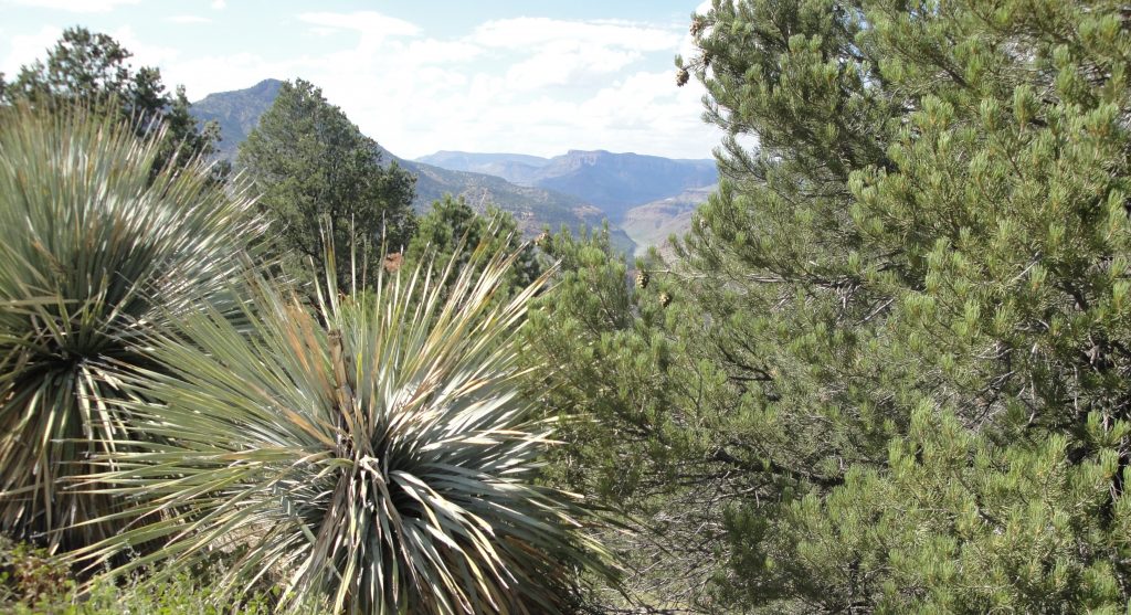
Below are views of the Salt River Canyon, as you come off the mountains into the Sonora Desert. Building the road must have been a heroic venture.
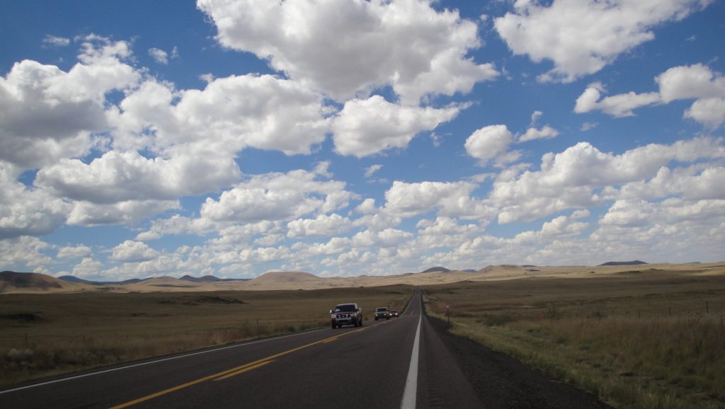
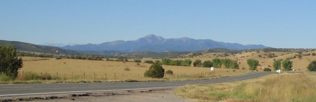
The New Mexico board of tourism calls their state the “Land of Enchantment” and they are right. As you drive across the middle of the state, you encounter a wide variety of beautiful ecosystems, lots of cute towns and great vistas. I drove along US Highways 70 and 60 and avoided the Interstate. Below are some pictures and comments.
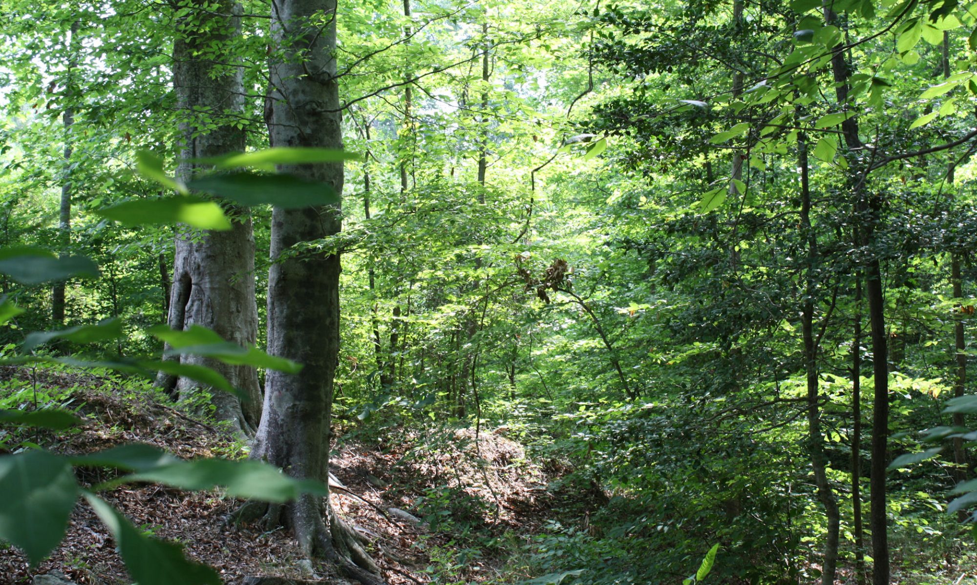
Above and below are examples of the changing biomes that sometimes sit within a few minutes drive of each other. Above are ponderosa pine. The open park-like terrains is naturally kept that way by frequent small fires. The ponderosa pines are fire-dependent. The young trees have black bark; as they get older -at around 100 years – the bark turns reddish. Ponderosa pines have a distinctive smell and you could tell you were near them with your eyes closed. I stopped at the roadside where I took the picture to experience that. Below is a mixed juniper and pinyon pine landscape. It is a bit drier than the ponderosa places. Pinyon pines produce “pine nut” consumed by local people and wildlife.
Below – as you get into drier places, the trees disappear and you get various types of grassland. I am less familiar with the specifics of those biomes.
Below is almost entirely grass. The modern things you see are the “very large array,” a series of radio telescopes used to explore the far reaches of the cosmos, from the far reaches of New Mexico. I guess that the elevation and clear air make that easier.
Below are lava bed. According to what I read, the lava oozed out around 800 years ago. Some plants have since colonized. It must have been nearly impassible on foot or in a wagon when people first found them.
I needed to get maximize my daylight so I left Portales just before the sun came up and for about an hour and a half I drove through some of the most monotonous landscape possible, sometimes made less appealing by the early morning gloom, I suppose. Sometimes there was little evidence of active human occupation. At other times you could see where people had moved away.
US Highway 60 runs through what was the edge of the Dust Bowl in the 1930s. The countryside had a denser population back then than it does now. This is a good thing. The land here gets irregular rainfall. In some years there is enough to temp people to plow up the sod and plant row crops. That is what happened right after World War I, when this area was booming with high war-time prices for wheat and other crops. A vicious cycle set in when prices came down off their highs. Farmers needed to plow up more grassland and grow more crops to make the same money, which they often needed to pay off their mortgages and the equipment they invested in during the boom time.
An agricultural method had been developed in the humid Eastern U.S., where rain is more consistent and where the wind doesn’t blow so hard or steadily. Something you notice even on a short trip is that the wind is persistent as a toothache out here.
The grass and prairie vegetation had protected the soils from the wind for around ten thousand years, ever since the warming following the last ice age. Prairie vegetation is adapted to the wet-dry cycles of nature and to the wind and fire that is endemic to the high plains. Most of the plants are perennial. They send down deep and interwoven roots. When the dry weather comes, these roots sustain the plants and hold the dirt.
The grassland ecosystem had created deep and rich soil over the course of literally thousands of years. During the wet decade following World War I, farmers essentially mined and used up this soil in an unsustainable way. They didn’t understand it and some thought the rain was natural or permanent. Many were probably surprised that nobody had discovered the bounty of the land before. The hotter-drier cycle set in again in the 1930s. Soil, exposed to the wind by plowing and harvesting just blew away, leaving some farms almost bare of topsoil and other buried in the stuff. This was the environment when thousands of refugees headed out. You read about that in John Steinbeck’s “Grapes of Wrath” or in a more recent non-fiction book called “The Worst Hard Time.” (I studied the dust bowl years when I was going to Iraq, since the dust storms there are also partially man-made catastrophes. It formed the basis of some of my slow-moving but grandious dreams)
We take better care of the soil today. During the 1930s farmers and government folks (like the CCC) planted windbreaks of trees. FDR had a special fondness for tree-planting. Of all his great and not so great traits, that is the one I find personally most appealing. Farmers now use low-till or no-till methods that leave the soils more intact and leave cover vegetation on the surface during the off-seasons. Years of experience has taught us that there are some grasslands that just cannot be made to produce any crops besides maybe hay and some that cannot-should not even do that.
An old farmer told me that this year was a good and a wet year on the high plains. He said that the crops, like the milo/giant sorghum were growing well and that the harvests were good. But today we know that this wet year will sooner or later – probably sooner – be followed by some dry ones. And we know that we need to keep and protect the environment for those times. Dirt is the basis of civilization and if you don’t care for the soil, there really is nothing left for you.
The picture up top in along US 60 in Western NM. The one below is up the hills a bit in the more central part of the state. The bottom picture explains itself.
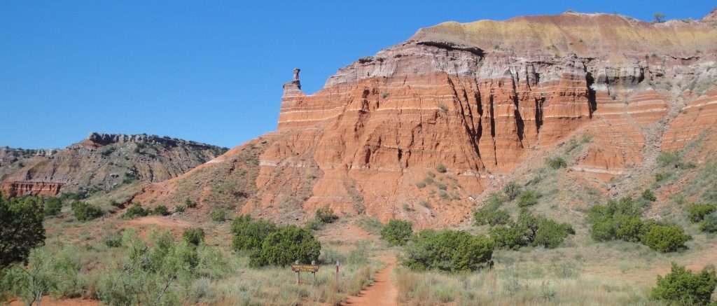
Palo Duro Canyon was sort of on my way, so I went a little out of the way to look at it. I only spent a couple of hours there, since I needed to get to a hotel and prepare a PowerPoint presentation for my talk at Arizona State University on Thursday. I still owe some work to the State Department, even here.
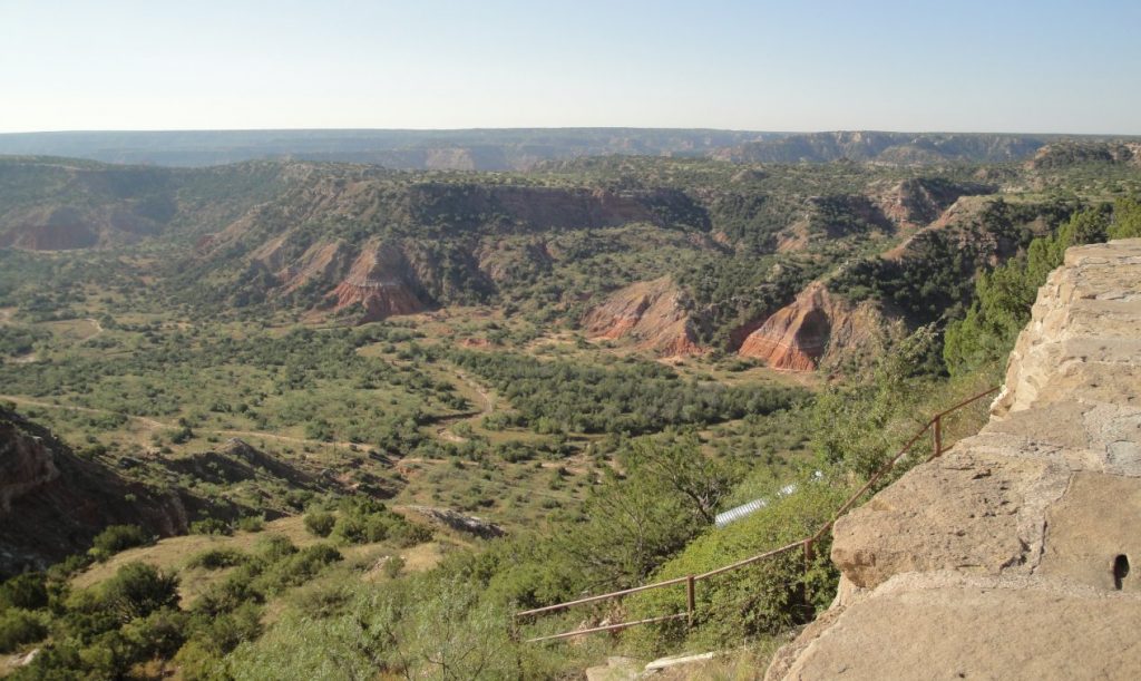
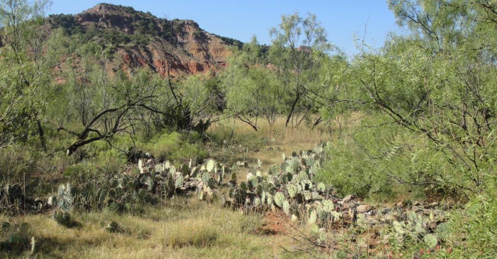
I did manage about an hour’s trail walk. The ground is hard and baked red, but the vistas were surprisingly green. I could tell from the still fresh mud around the waterways that they had a fair amount of rain this season. In fact, the road was closed in one place because of the water, as you can see below.
Palo Duro used to be home to the Comanche. They used to herd buffalo into the box canyons to make it easier to slaughter them. Later Charlie Goodnight, who I wrote about in the previous post, used the canyon in similar ways to herd cattle. Today it is a Texas State Park.
I enjoyed the vistas and the silence during my walk. I realize how much good it does me to get away into these sorts of natural places. I just feel good mentally and physically when I can hope around on rocks with the varieties of nature all around. I have a different appreciation of arid lands since I was in Iraq. Most places are less barren than Anbar, so everywhere is a step or more up. This land isn’t really arid anyway, just semi-arid. There is a lot of life in the canyon and on the prairies above and even the erosion is beautiful here.
The CCC and the WPA built many of the roads and walls during the 1930s. There was an exhibit re in the museum. It is very nice for me to walk around today on a developed trail in the relative cool and comfort of a nice late September day. It must have been something else for those young guys to live in tents and actually build the trails I enjoy. My father was a CCC boy, so I always feel a little bit of a connection to whatever they do. I always feel grateful for the work they did what is getting to be a very long time ago.
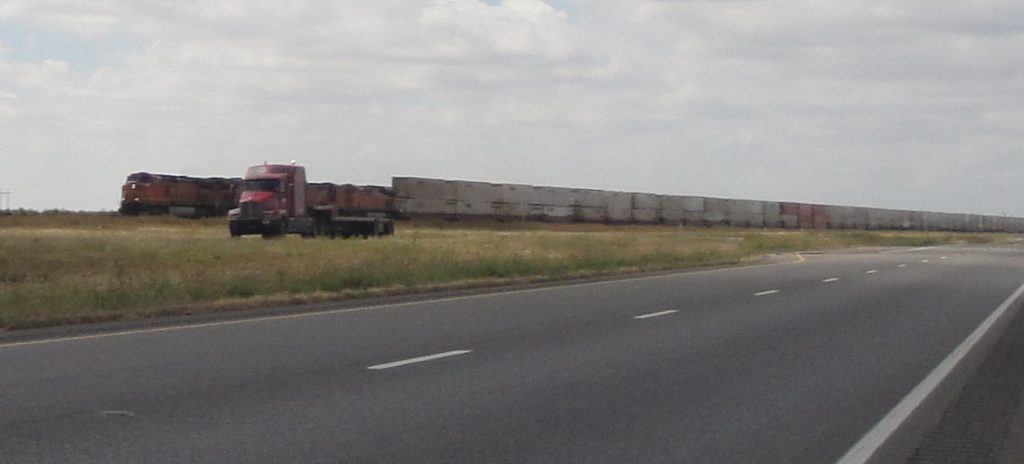
It seems like I was constantly passing trains, as I drove along US 60 from Canyon, Texas to Clovis, New Mexico. Trains came by in both directions every few minutes on the tracks parallel to the road. Many of them were loaded with containers or with actual truck loads. I kept on thinking how good it was that all those trucks were on the tracks and not with me on the road.
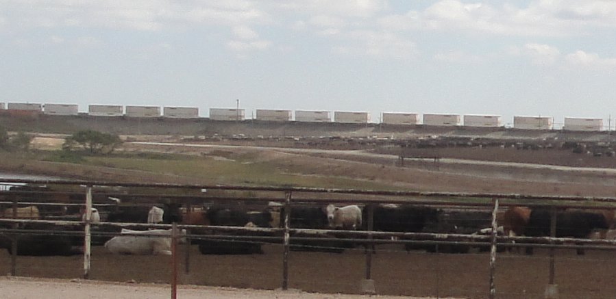
We have the world’s best freight rail system, as I wrote in a posts a few weeks ago. Seeing it in actions, over and over and over again, reminded me. Above is one of the trains passing one of the trucks. How many trucks would it take to move the stuff on that train? Below is the feedlot, but look closely behind. What looks like crenelations is another passing container train.
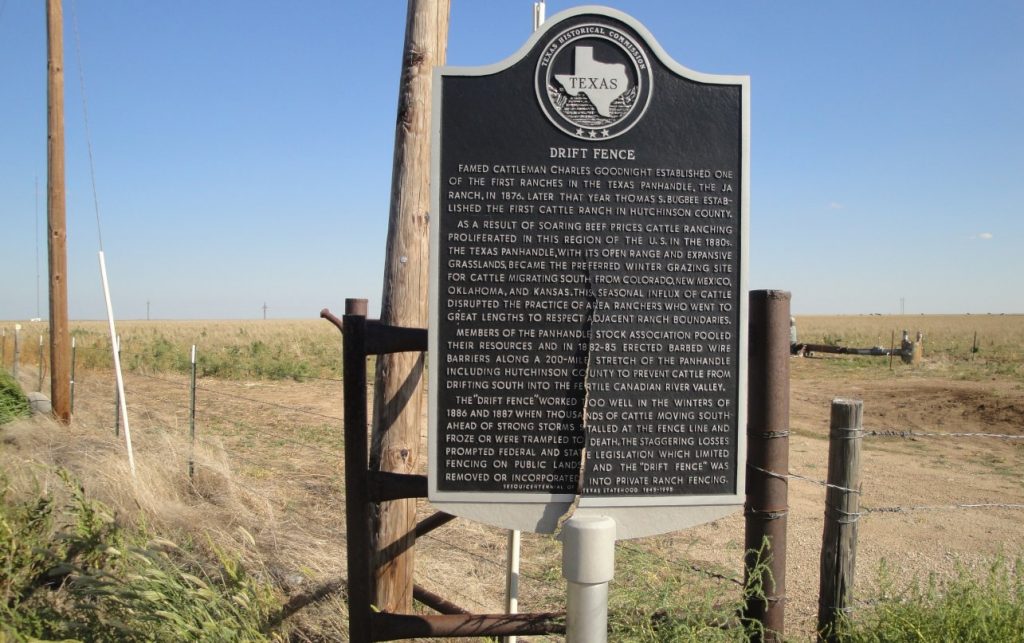
I am getting to know Charlie Goodnight by his work, which is the truest way to know someone. As I drive through the Texas Panhandle, it is impossible not to. I saw the historical markers for his “drift fence” to keep the cattle from drifting south in winter. There is a reconstruction of his dugout house in Palo Duro Canyon, where he ran cattle. The man is a real western hero. He was a Texas Ranger, fought the Comanche & later helped make a treaty with their last great war Chief Quanah Parker, pioneered cattle trails, the biggest, the Goodnight-Loving trail, went from Texas through Colorado and all the way to Wyoming, and built a ranch and an industry in Texas cattle. When he was all done with that, he helped save the Bison from extinction. The Bison in Yellowstone, on Ted Turner’s ranch and around the West are to some extent descended from the herd that Charlie Goodnight protected on his ranch.
I recognized Goodnight. I knew him from western movies and my research showed that this was the case. He was the inspiration for a raft of movie cowboys. One of the ones l like the best is “Lonesome Dove.” The character of Captain Woodrow Call, played by Tommy Lee Jones, is loosely based on Goodnight and the Gus character, played by Robert Duvall, is based on his friend Oliver Loving. Loving and Goodnight ran cattle as in the book/movie. Like Gus, Loving was fatally injured in an Indian attack (Comanche) and died of gangrene. Like Woodrow Call, Charlie Goodnight brought his friend back to Texas to be buried. You can also see the Goodnight character in a movie like “Red River” with John Wayne. In fact, Charlie Goodnight was one of the characters that I knew best, although I don’t recall actually hearing of him until recently.
There is so much to this man, I suggest you look him up and read more. Suffice to say that few men have had such an eventful and exciting life. His real life is like a fictional western, actually a series of them. We shall not soon see his like again.
The picture up top is a reconstruction of the dugout cabin where he lived while settling the area. Below that is a nearby stream, typical with its cottonwood and willow, probably his water source, certainly a watering place for cattle. Access to water was the key to success. They had an saying, “Whiskey is for drinking; water is for fighting over.” The last picture is a feedlot. There are lots of lots around here. The old round up and cattle drive has changed a bit. BTW – Goodnight also helped improve the herds. Among his other contributions was introducing Hereford bulls into the gene pool. The Longhorns were picturesque, but there is better beef. Beef – it’s what’s for dinner, to some extent thanks to old Charlie.
I had more time today, so I could do a leisurely drive through Kansas and the Texas panhandle. I took the little roads and sometimes I was the only one on them. The day was perfect, cool, but with a warm sun. The panhandle is high, sometimes as much as 3500 feet. One reason I was enthusiastic about visiting the Texas high plains was that they are similar to the planalto – the South American high plains where Brasilia is located. Above are pronghorn antelope. There were dozens of them just standing around. They are supposed to be the fastest animal alive over more than a short sprint. I don’t know. They weren’t running.I thought of running out there after them, but what if they didn’t run?
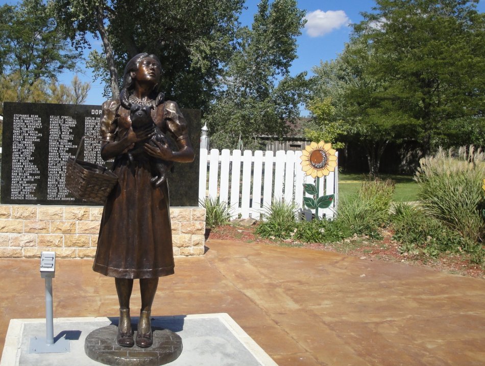
Above is Dorothy from the Wizard of Oz in Liberal, Kansas. They evidently have some kind of pageant. The names in back of the statues are previous Dorothys.
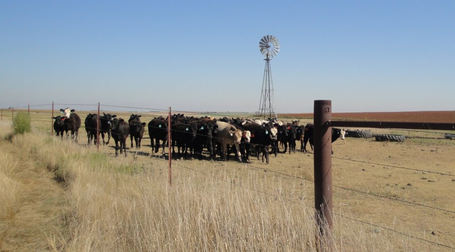
Above and below are cows at the watering hole. I thought they looked very picturesque, iconic with the old fashioned windmill pumping water. It was very quiet, so also imagine the squeaking of the windmill and the mooing of the cows on the empty and quiet plains. I took a picture from a distance. As I walked up for a closer look, they all came to me. They were very friendly animals. The solid rust red stuff in on the little hill in the background is milo, or giant sorghum. I saw a lot of it on this trip. It ripens to that color. They use it as a feed crop on the dry plains, much like farmers use field corn in the East. I didn’t know that either, but an old man explained it to me. He also said that it was a very good year in the panhandle – more rain than usual. It still seemed dry to me, but the milo was pretty.
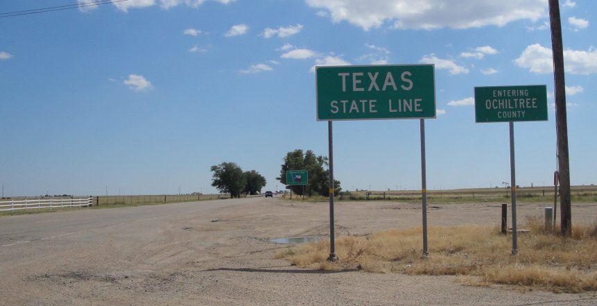
Below is the Texas state line, just a line on a map with no geographical feature to mark the change. I suppose lots of state lines are like that, but it seems more true here where it is so flat and featureless.
Below are mammoth bones found locally. They are now in the Museum of the High Plains. Admission is free and the guy running the place is extraordinarily friendly. He told me that they use the buildings for wedding receptions and community events and that the museum survives on that income as well as from the generosity of visitors. I bought a T-shirt and made a donation.
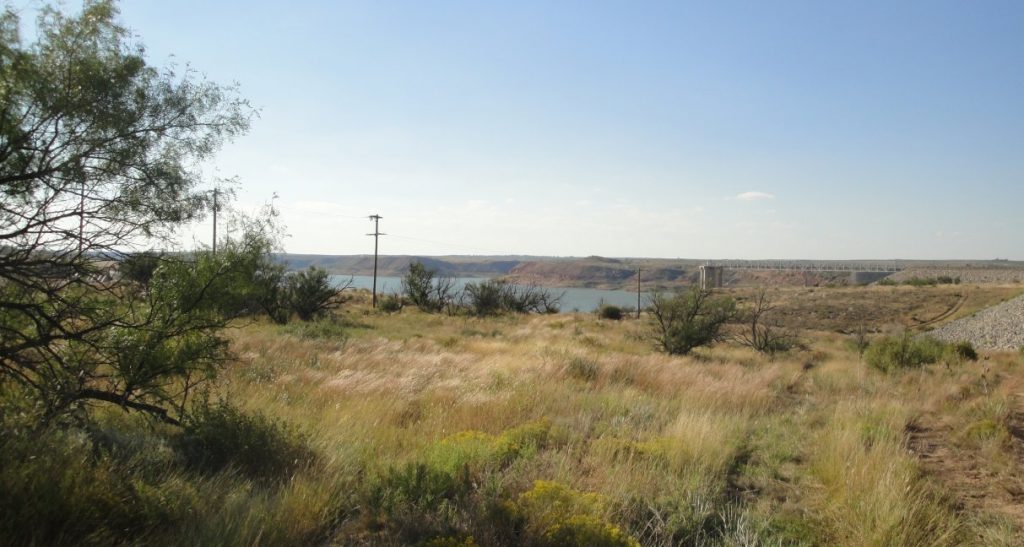
Below is Lake Meredith. It is seasonally bigger or smaller. My photo didn’t properly catch the colors, but it was very attractive. Take my word.
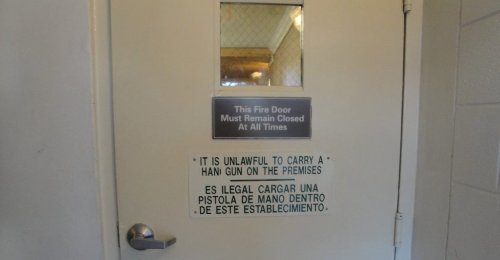
Finally, the picture below speaks for itself. What’s the country coming to if you cannot take your gun to the hotel even in Texas. Seen from another perspective, interesting that they need a sign.
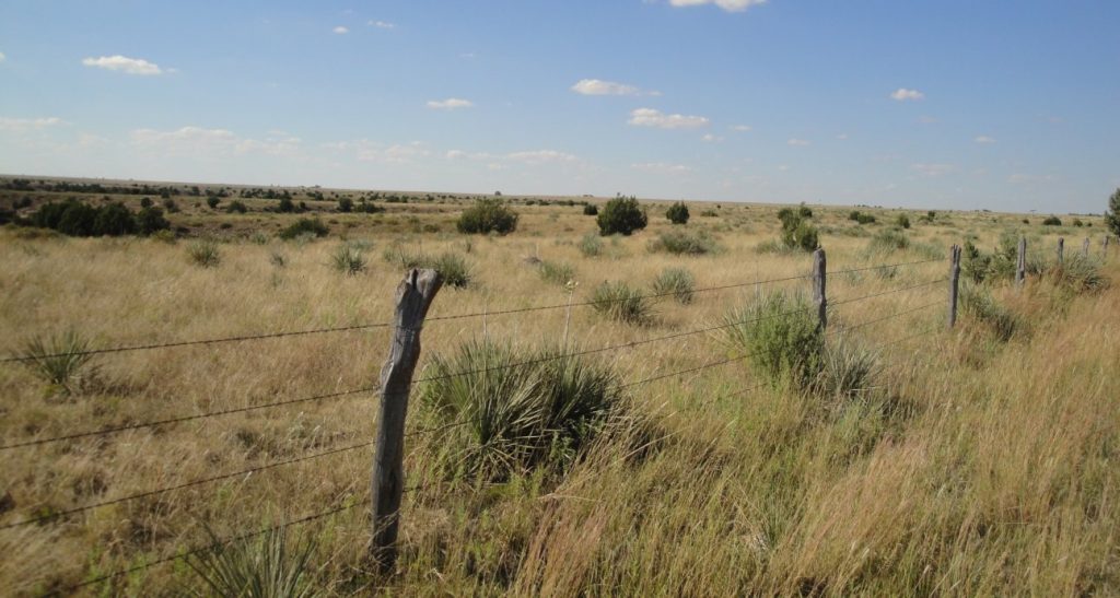
You don’t know open space if you live on the coasts. The middle of America has a lot of emptiness. They called it the sea of grass and the metaphor is apt. In many places the land here is as featureless as the sea. Above is a landscape near Perryton, Texas.
I am interested in the high plains. The Spanish explorer Francisco Coronado (his statue is above in Liberal, Kansas) named it the Llano Estacado, which means palisaded plains. There is some disagreement about what he was describing, but the most accepted explanation is that the plateau starts with escarpments that look like fortification palisades or a stockade. I didn’t see this “fortified” part, since I came from the north, where it is less abrupt.
I have been listening to the audio book Empire of the Summer Moon, about the rise and fall of the Comanche. The Comanche were primitive and not very successful Indians until horses came to the Great Plains after they escaped from the Spanish. They quickly learned to use the horse and it changed their tribe. The mobility provided by the horse allowed them to kick other tribes, mostly Apaches, off the Llano Estacado in what would be called a genocidal war if it happened these days. Like most horse nomads, the Comanche were violent and cruel. Their main passion was raiding, which included lots of torture, rape and pillaging. It was essentially a type of terrorism designed to … well terrorize opponents.
The Comanche were a formidable fighting force. They stopped the Spanish conquests and held back the Mexicans. One reason why the Mexicans welcomed Americans settlers in Texas was that they wanted a buffer against the Comanche. Nobody could really cope with them until the Texas Rangers learned to fight in the mobile and flexible fashion used by the Comanche themselves. It takes a network to defeat a network. The revolver was a great help in fighting the plains Indians. An Indian with a bow enjoyed an advantage over a man armed with a single shot rifle or pistol. The six-shooter evened the odds. The U.S. Cavalry finally defeated the Comanche in the 1870s, mostly by sheer persistence helped by the destruction of the buffalo herds.
Above is the marker for the battle of Adobe Walls. There were two of them here. During the second battle the Comanche were attacking buffalo hunters holed up in an adobe inn. Although there were 700 Indians and only 29 hunters, this was a bad idea. The Indians couldn’t burn the hunters out, since adobe doesn’t burn and the hunters were well armed with long-range rifles. They were able to shoot the Indians at very long distance. Read about it in the book I mentioned.
Dealing with the tribes reminded me of the tribal diplomacy in Iraq and defeating the Comanche “insurgency” probably still has lessons for us today. Anyway, it is a good book and I recommend it, especially the audio version that you can listen to in the car as you drive across the endless sea of grass where the Comanche used to ride.
I have more pictures and thoughts re the high plains and will post more. It was a good day to look around.
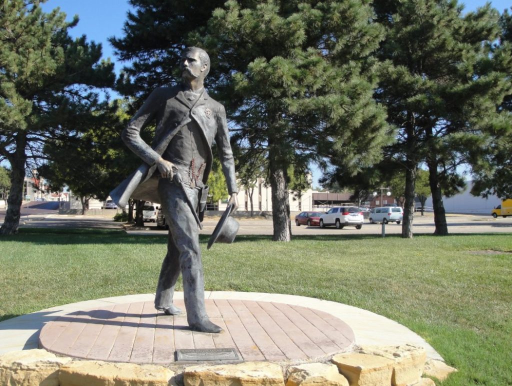
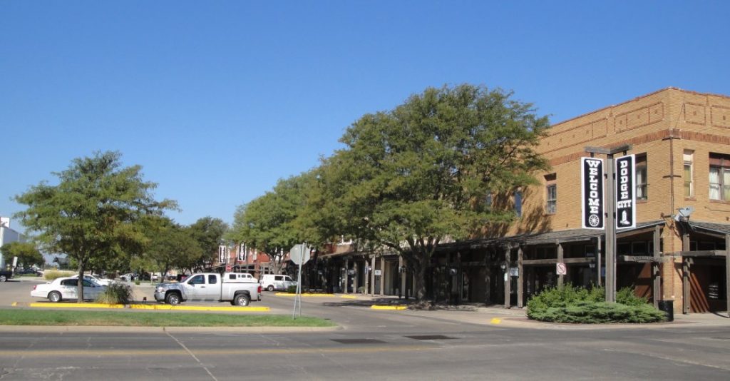
Dodge City makes a much bigger impression on American folklore than it does on American geography. Above is Wyatt Earp, one of the town’s most famous marshals. Others included Bat Masterson & Charlie Basset. There really isn’t much here anymore really of theirs. But I wanted to stop anyway. I am beguiled by the legend. Below is what is left of the “real Dodge.” The parking lot occupies the space where all the taverns and whore houses used to be. The real Dodge of the old west was probably flimsier and less permanent than the movie sets made to portray it. They were always worried about it burning down and the good citizens of the city finally got rid of what they considered an eye-sore that attracted the wrong sort.
So many of our Westerns are set in Dodge. I grew up watching Gun smoke with James Arness as Marshal Matt Dillon. Each episode started off with Matt winning a gunfight in the streets of Dodge. Westerns were popular when I was a kid. You wonder why any bad guys would ever show up in Dodge with Matt Dillon around. He gunned down a couple of them every week. I wonder what the cumulative total was.
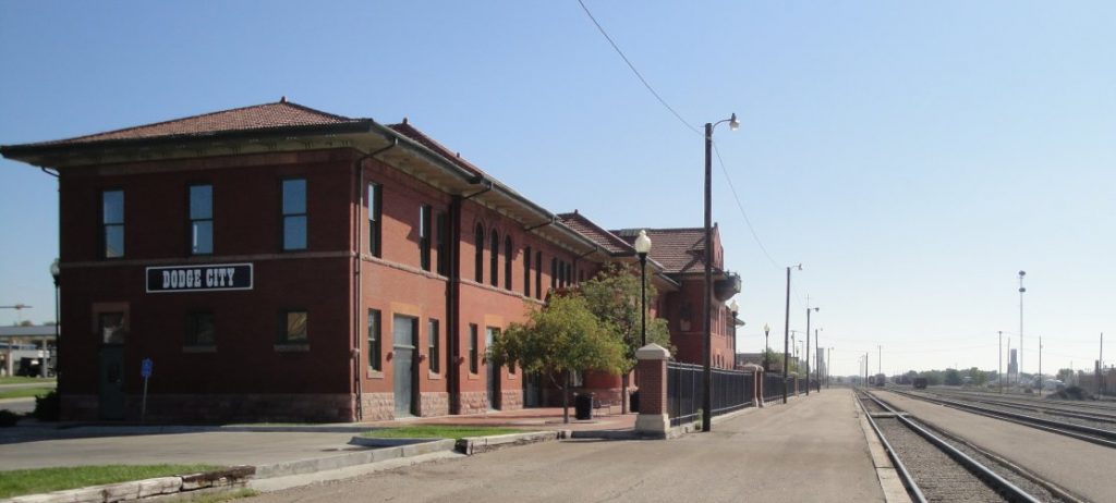
Cumulatively, I bet there are more total hours of TV and movie time about the Wild West than there was during the actual Wild West period. Dodge City was at the end of a branch of the old Chisholm Trail. It was where the big herds from Texas met the Railroad. You can see the rail depot and tracks above and the longhorn below.
Dodge was the big cattle town for about ten years. It replaced Abilene as the railroads moved west. The cowboys didn’t want to drive the cattle any farther than necessary. It was hard on the men and on the cows. They lost weight and hence value, so they loaded them on rail cars as soon as they could. The whole period of the big cattle drives – the Wild West – was only around twenty years from around 1870-1890. After that, rail transport became widespread enough that the days of the picturesque but dangerous and grueling cattle drives were over.
When you think about it, life on the frontier was not much fun. The settlers understood this very well and fact, tried to bring civilization (such as the Carnegie Library, now an art center, pictured above) as fast as they could in order to avoid all the excitement of gunfights and Indian raids. But if you don’t actually have to live through these those sorts of things, they capture the imagination. In the absence of danger, everybody imagines himself the hero. It is exciting in retrospect to have built something up, wrested from hostile nature and dangerous primitive men.
I was vaguely aware of the Amana Colonies, but the name was familiar mostly because of Amana appliances. In fact, as I write this in the Holiday Inn in Dodge City, the air condition is an Amana product. But there is much more to the story than stoves and refrigerators.
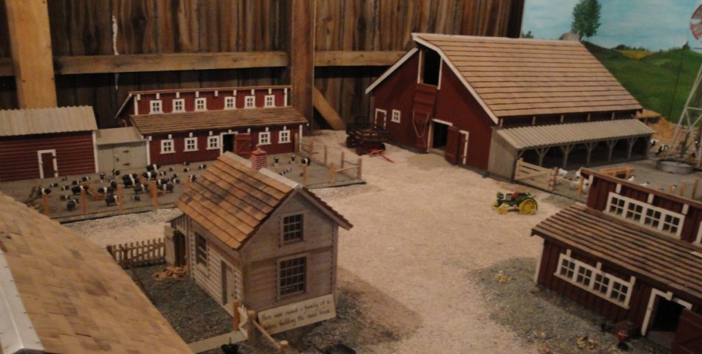
There are seven Amana colonies in Iowa. They were founded in the 1840s by a German sect. They were related to Lutherans, but had a more communal point of view. It is the usual story. They were persecuted in Europe, so they came to set up a new life in America. Below is a model of one of the farms. There is a “barn museum”. It has models of all sorts of local buildings. They were all made by a single local guy with a lot of time and significant model making skills.
These kinds of colonies were successful in the U.S. because the adherents believed in hard work and were well disciplined. That is pretty much all it takes to be successful in America. The thing I like about the German-culture sects is that they have very well organized agricultural operations and they don’t shun beer. Beer is a integral part of central European culture. IMO, it is an integral part of pleasant civilization, but that is another story.
The Amana colonies were integrated agricultural enterprises. They are not like the Amish. The Amana folks embrace technologies and machinery. Farms were communal until 1932, when they all got shares in an Amana corporation. They farmed, processed farm products, made crafts and later on even made appliances. The Amana Corporation, which is still in existence, still runs a prosperous enterprise. I was interested in that they own and manage a large – 7000 acre – forest reserve. It produces forest products and is run sustainably. The hardwoods from the forest supply the wood for their furniture making businesses. A guy I talked to told me that they do TOO good a job with wildlife. He cautioned me to be careful driving around because the deer would be jumping over the road, especially at dusk.
Beer drinking, hard working, not complaining and forest loving – I like these people.
As you drive around in the American countryside, you realize how many of these sorts of groups there were – and still are – in America. We tend to forget about them or think they are just historical artifacts. But they seem to have developed sustainable systems, both in the natural and the human ecology. We talk about diversity in America. This is actually a very important part of it.