Deserts & High Chaparel

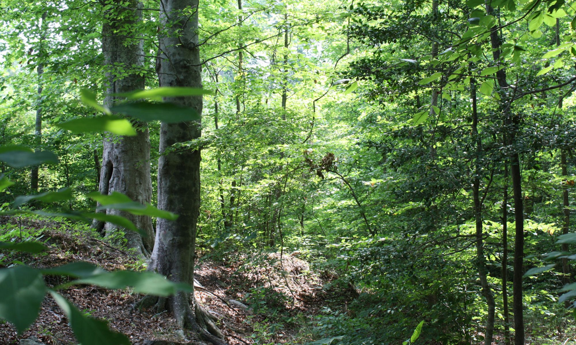
We drove south to Tucson and then east through the Sonora Desert.  The Sonora is the desert we all think of as THE desert.  It is the hottest of our American deserts, the one with all the cactuses that we know so well from the western movies.  We visited my cousin Elise and her husband Carl who live near Tucson.  I wrote re that last year here and here. The Tucson area is higher, greener and cooler than Phoenix, although both are in the same biome.

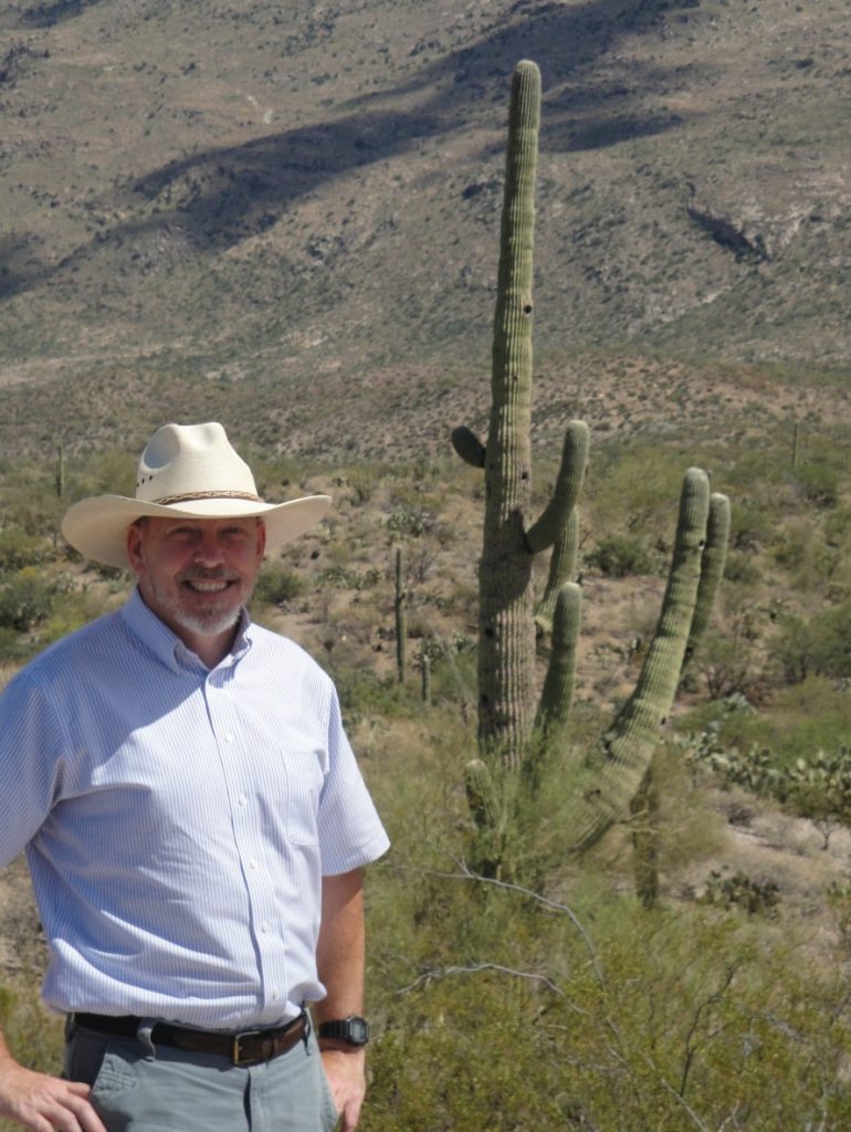
On the side is me with my new hat (purchased in Texas) in the desert. The hat is made of palm leaf and it really does keep the sun off and the head cool.  I like it.  

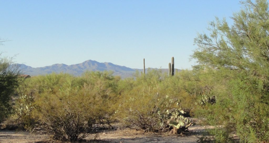
Just outside Tucson is the Saguaro National Park, where I took the pictures of the Sonora Desert vistas.  The saguaro cactus is the one with the arms that looks like a man flexing his muscles.  It takes many years for them to grow big enough to get arms.  You can tell you are in the Sonora when you see the saguaro, which grow naturally nowhere else.

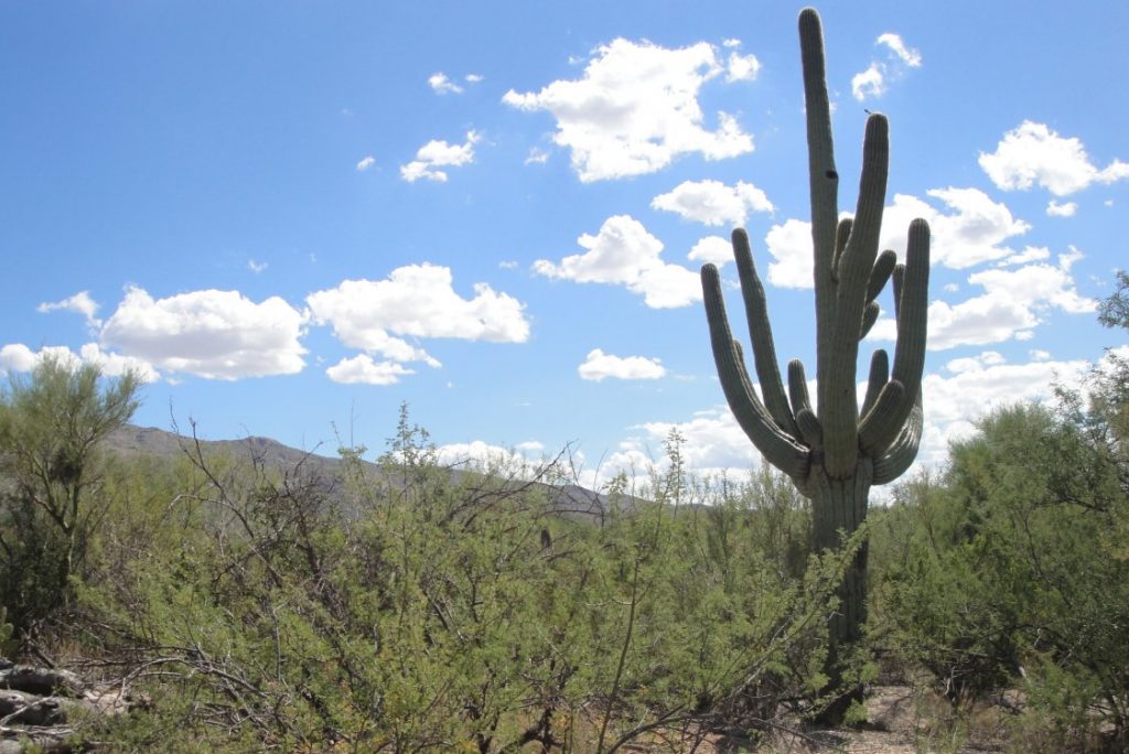
Above and below are Sonora landscapes

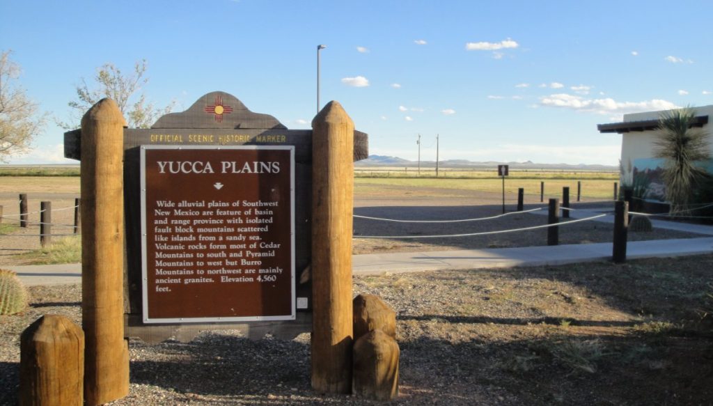
Below – the flat area behind the sign is – believe it or not – the continental divide.  At some point out in that field, if you peed some would go toward the Pacific and some toward the Atlantic. We are actually at a fairly high elevation.  It is just a flat plateau.  I don’t know how exactly they can tell which way the water would flow. I always thought of the continental divide as a sort of ridge. 

North and west of the Sonora is the Mojave Desert, which I wrote about last April, with its characteristic brush and Joshua Trees.   You hit the Chihuahua Desert as you go east.  It is not true that the Taco Bell dog’s wild ancestors roamed this region.  The Chihuahua desert is theoretically less harsh, but it seems to have a little less interesting life.  I guess that the Sonora is very harsh, but fairly consistent, which allows varied life forms to develop.

The Desert Speaks

We spent our last day in Arizona at the Bryce Thompson arboretum, where you can see trees and plants native to the desert southwest, the Sonora and Chihuahua regions, as well as those from deserts in South America, Africa and Australia.

Desert landscapes are strange for someone who grew up in Eastern North America, although the Sonora vegetation is vicariously familiar because of all the cowboy movies.   Almost everything has thick skin and thorns and takes a long time to grow. 

The exception is the gum tree or eucalyptus. It is a type of miracle tree from Australia.  It can grow very fast in dry harsh conditions.  This wonderful capacity for growth and adaption has made eucalyptus an invasive species.  It can often out-compete the native desert flora, but it provides little for wildlife to eat.  

Kuala bears eat the leaves, but most other animal avoid them. I suppose this is because they smell like Halls Mentholypus cough drops and probably taste like them too.  It is an acquired taste.  Like everything else, its value can be judged only in context.  Eucalyptus are great trees to provide shade, cover and erosion control.  They get big. The one pictured below was planted in 1926.  And they are attractive individually and in clumps.

Date palms were familiar from Iraq. Dates are a very productive desert tree.  I have written about them before. I cannot tell them apart, but I understand that there are dozens of varieties.

An arboretum is not only a pretty place. It is also a place to learn about natural communities. They say the desert speaks, but I like to have someone put up a few signs to interpret it for me.  The biggest surprise was an Australian she-oak.  It is not related to our oaks (quercus).  I had absolutely no idea what it was.  Below are Maleah, Diane & Christiana in the date palm grove.

Take it Easy

Lighten up while you still can

We finally got down to Winslow, Az.  Winslow is world famous among fans of the 1970s pop group “The Eagles,” since one of their hits “Take it Easy” features a hitchhiking vignette when the singer is “…standing on a corner in Winslow, Arizona.”   We didn’t actually see the corner, although I looked for it and evidently drove past it on the way to Highway 87.

Burning Brush

The geography changed as we climbed from the semi-arid grasslands through juniper and back up to beautiful ponderosa pine forests. I regret that it was getting a little late and we were losing the light so I couldn’t tarry longer.  This is part of the Coconino National Forest and the Forest Service was busy burning the brush.  We saw a lot of smoke and even some flames.  You can see the smoke in the distance in the picture above. I am encouraged to see the proactive use of fire to restore the landscapes.  The park-like ponderosa forest, with its interspersed meadows, is one of nature’s most beautiful communities.  Below is a well-managed ponderosa forest.  The ones with the red bark are at least 100 years old.  Younger ones have black bark.

Cool Air and Cooler Sunsets

Although Arizona was experiencing a heat wave, and temperatures in Phoenix were reaching into the nineties, the air in the piney woods was cool.   The thermometer in the car registered 59.  You might think you were driving through upper Michigan.  As I wrote above, we were losing the light and I didn’t want to drive the narrow, curvy roads in the dark, so we cut sideways to catch I-17.  We saw one of the most beautiful sunsets I have seen with red clouds turning purple before going dark.  I think the smoke from the prescribed fires contributed to the color.  I didn’t even bother trying to get a picture.  Beautiful sunset pictures are cliché.   Part of the beauty of a sunset lies in its ethereal & ephemeral elements.  Taking a picture is like trying to grab a handful of air.  

The picture above is taken near a gas station in Happy Jack, AZ.  Interesting name for a town.  We didn’t see the actual town. 

We lost altitude as we approached I-17 and the temperature rose to 81 degrees, in spite of the coming of evening.   It was 86 by the time we got to Phoenix.  Back in the desert.  It is interesting that you can get such changes in such a short time and distance.

Navajo & Hopi Nations

Anybody can eat when he is hungry but it takes a real man to eat when he’s full.

We went east away from the Grand Canyon into the Painted Desert and the Navajo and Hopi nations.  We stopped at a “trading post” in Cameron. 

Information about our trip through the Navajo nation in 2003 are at this link, BTW. 

They had a nice restaurant with very friendly staff and an old fashioned ambiance.  I had Navajo stew, which tasted a lot like traditional beef stew.  It came with fry bread, which is excellent, and the portions were generous.  Chrissy just had the cheese burger and fries. Usually I help Chrissy finish her lunch.  This time I failed. The fry bread is very filling.

That fry bread is really good. I enjoyed it just by itself and I tried a little with butter and honey. Then I got the great idea that it might be even better if it had some tomato sauce, melted cheese and maybe some sausages and mushrooms.  Maybe I should check to see if anybody else has had a similar idea before I open my restaurant.

Space & the Eternity Highway

There is a lot of space out here.  Chrissy joked about those signs you sometimes see on developments, “If you lived here, you would be home already.”  These roads are near nothing. We saw a few lonely cows and horses, but not much else. Sometimes I wondered if we were really moving.  Although we were going 65, the horizon didn’t seem to change. This is the kind of landscape featured on SciFi.   The aliens could abduct you out here and nobody would see.

Proper Picture Protocols

We stopped at the Hopi Museum.  I cannot show you pictures from the actual museum. (The best I can do is the cool looking gas station above, which I assume is culturally appropriate.)  A sign at the museum admonished visitors not even to take notes.  The $3 you pay for admission only goes for you.  Other signs warned that you would have your camera confiscated if you took pictures of various villages or activities. So I don’t have pictures of the Hopi stuff.  I have some Painted Desert pictures below.  There was nobody out there or much sign of life in general.

I have a good memory and could probably tell you about the things I read and saw at the museum, but they seemed unenthusiastic about this sort of sharing, so better not.   Suffice to say that there were some excellent black and white photos from around a century ago of people and places as well as a display of Kachina dolls with narratives complaining about Kachina doll knockoffs and/or imitations based on the concept. 

There was also a lot of information about a boundary dispute between the Hopi and the much larger and faster growing Navajo Nation. As per instructions, I didn’t take notes, but seems that things were not going well. The Navajos and Apache arrived in the area a few hundred years ago and this is only the latest round.  According to the last census, there are almost 300,000 Navajos and fewer than 7,000 Hopi.  The numbers explain a lot.

I framed an excellent picture in my mind.  Outside the museum there were a bunch of guys selling things like firewood, rugs and Kachina dolls from little stands or the backs of pickup trucks.  In the background were spaced pinon pine trees.  Very picturesque.  But business didn’t seem too good and I was intimidated by the picture prohibition.  I didn’t know if I could take a picture or not, but why chance it?  You can find out all you need to know from “National Geographic” and they have better photographers who know the proper picture protocols. I hope I didn’t anger the Kachinas.

Teddy Roosevelt & the Lodges

Above is the hotel were we stayed. The El Tovar lodge has that rustic elegance characteristic of the early 20th Century.  It was built in 1905, financed by the Santa Fe railroad as a sort of rail destination. President Theodore Roosevelt took the first steps to preserve the canyon about that time and the lodges here reflect that muscular personality of Roosevelt and America of that era. The Canyon was declared a national monument in 1908 and a national park in 1919.

The dark log walls are studded with actual heads of moose, deer, mountain goats and even bison.  I always wanted a moose head for my wall, but I have never had enough walls to handle something as big as a moose head.   You need a really big room with really high walls.  Actually, you probably need something a lot like the room in a big lodge. Moose are not native to Arizona, BTW, so the head came from somewhere else.

Below is Bright Angel Lodge. 

Feeble Imitations

The pictures I took of the canyon do not do it justice.  It is hard to get my camera to adjust properly to the combination of bright light and dark shadows.   Even when the light works, the colors don’t show exactly right and it is impossible to convey the depth.  But this is the best I can do.  You will have to come here yourself.

The light seems to spill into the canyon when the sun is just over the rim.  There is still a little haze in the air.  I think it is left over from prescribed burns to manage the neighborhood forests, as described in earlier posts.

Grand Canyon panorama AM

Above & below are canyon panoramas.  The bottom one was taken just at dusk, so there are not the shadows.   When you see the canyon in person, the shadows make it much more beautiful as you eyes can move and adjust.  But the pictures come out better w/o the sunlight.  I bet the nicest photos could be made when high clouds blocked some of the direct light. 

View Master

The best pictures of the Grand Canyon were the old View Masters I had as a kid.  The canyon seems very familiar to me today because of the many visits I made via View Master.  The simple technology worked great and the fact that we didn’t have very many options gave me the exposure I still remember more than forty years later.  

The Real Thing Requires a Little Pain

Everything goes in and out of the Canyon on mules or people.  They don’t bring machines, which makes the trails and facilities more primitive and much nicer. 

I hope it never changes. IMO, views and experiences are better when you have to earn them.  Some day I will be too old to make the journey and then I will have only memories and pictures. So sad, but so right.

I don’t want it to be made easily accessible for me or anybody else. Not only would that impact nature adversely, the experience of the Canyon would be different and much shallower if you could just drive down in air conditioned comfort or take an elevator.

It is that way with most things.  A rest you earn with good hard work is different and better than when you just get to lay around.  Achievement easily given is not achievement you value. 

Most people stay on top and marvel at the beauty in a more detached way.  Good. Keep it that way. The more spiritual experience requires a little more skin in the game. The sweat and exertion are part of it.  An erzatz version would be worse than nothing, or at best a feeble imitation.  We already have too much of that in today’s world. 

Four Legs Good; Two Legs Bad

Chrissy and I went down as far as Indian Gardens.  This is an oasis on the Bright Angel trail and it is the logical terminus of a day hike for a person in average condition.  It took us around three hours to get down but only around two and a half hours to get back up.  It doesn’t make intuitive sense.  I think it is because of all the rocks.  I walk gingerly among them going downhill.  We also had to get to the side of the path to let hikers pass who were coming up or mule trains coming down. There was less oncoming traffic on the return trip and no mule trains came past. 

Of course I am not counting the leisurely lunch-break we spent at Indian Gardens.  The cottonwoods and willow make very pleasant surroundings.  Both are fast-growing adaptive trees but are often unloved because of their weak wood, short lives and susceptibility to wind damage.   Of course, it depends on where they are.  As long as they are not near houses or roads, they do just fine.  Except that they grow in generations, i.e. a lot of them come up the same time and whole clumps grow, live and die together.  This is not a problem except during generational change, when the whole clump of cottonwoods begins to die back about the same time.

PS

The morning later I my complaining muscles reminded me that I am no longer in the top condition I used to imagine.   The pattern of pain was interesting, more characteristic of overdoing cross country skiing than overdoing ordinary hiking.  I suppose it is because of the poles. 

My legs hurt a lot less than I would have guessed, but my arms, chest and lats are screaming. 

I used to cross country ski a lot when we lived in Norway.  I am sure I used the poles the way the Norwegians taught me, which is to push off in back of your body instead of leaning forward on the sticks. I recognize the feelings.   The good news is the pain confirms that the poles worked.  I pulled myself out of the canyon w/o overstraining my legs or knees.  

As they say (for different reasons) in “Animal Farm”, “Four legs good; too legs bad.”

PSPS

The link to my earlier trip down the canyon is at this link.  That time we did it in 117 degree heat and went all the way to the river and back.  That was stupid.  The bottoms of my shoes melted off on the hot rocks. Really. 

This time we had perfect weather. Cool at the top and only warm near Indian Gardens. AND we didn’t go all the way down.