Dinosaurs

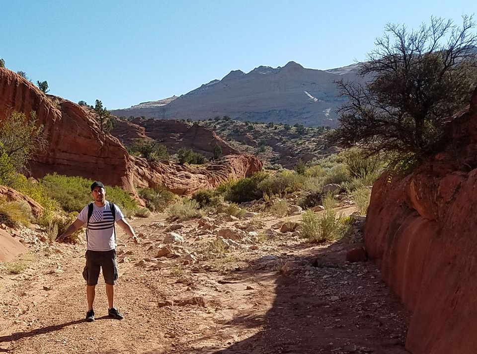
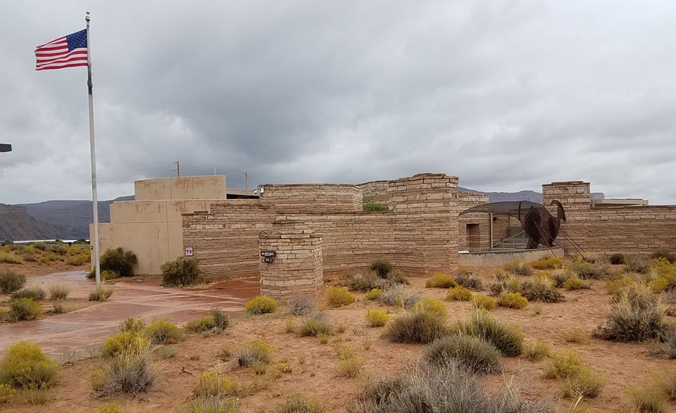
Alex and I visited Dinosaur National Monument, near Vernal, Utah. It is literally a dinosaur quarry.

What is now Utah was wet and tropical in the Jurassic Period, and a river ran through it. This river attracted dinosaurs and over the eons some of them died and fell in.The river washed their remains together, where they were covered by sediment and some of the bones turned to stone. There is a survivor bias among the bones. Small animal remains were just crushed, while the big ones persisted long enough to turn into fossils.

With changes in climate, the river ran dry and the former river bed was buried. But the earth never rests. As plates moved, the former river bed was tilted and thrust up to the surface.
The dinosaurs rested in the rock until 1909 when Earl Douglass of the Carnegie Museum went to Utah to search for dinosaur skeletons. This is where he found the mother lode.
The four corner area is the richest dinosaur region in the world. It is not so much that there were more dinosaurs living here, or that there are more preserved here, but the dry conditions and exposed rock makes them easy to find. It is also the case that there were/are more people looking for fossils in the U.S. than in most other places. It is likely that the local Native Americans occasionally stumbled on these fossils, and may have noticed them, but with no scientific or cultural infrastructure, they remained only curiosities, maybe not even that.

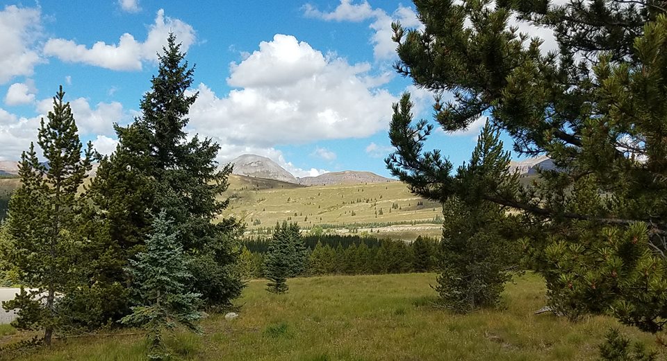
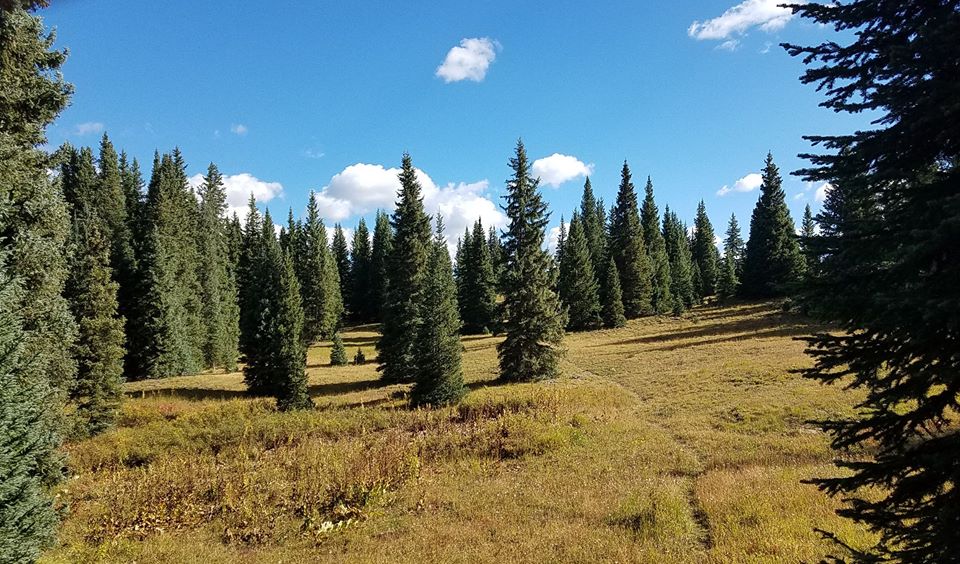
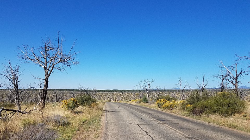
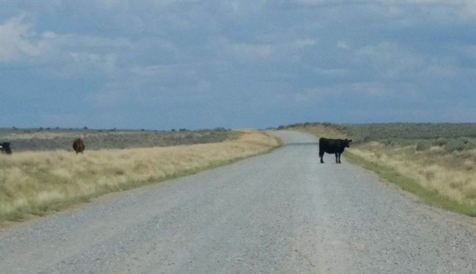
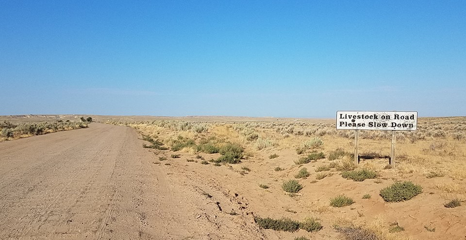
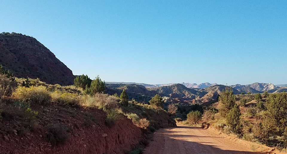
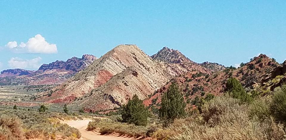
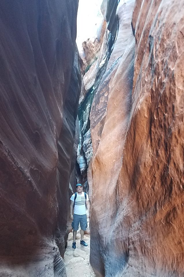
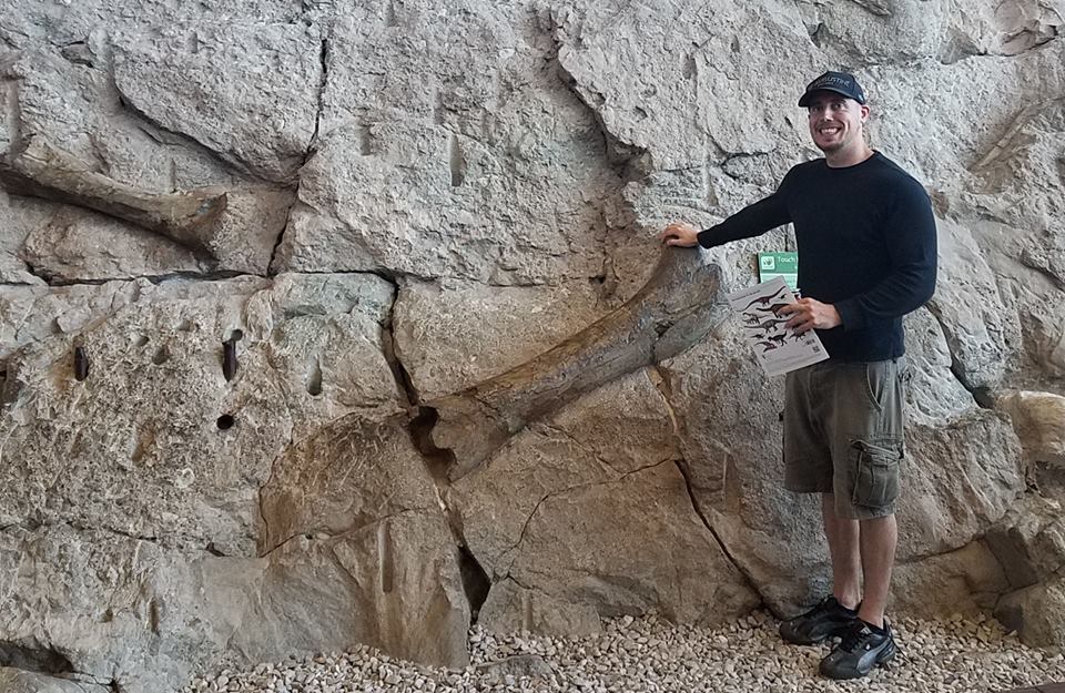
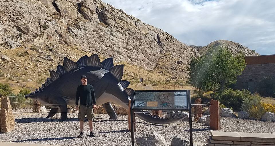
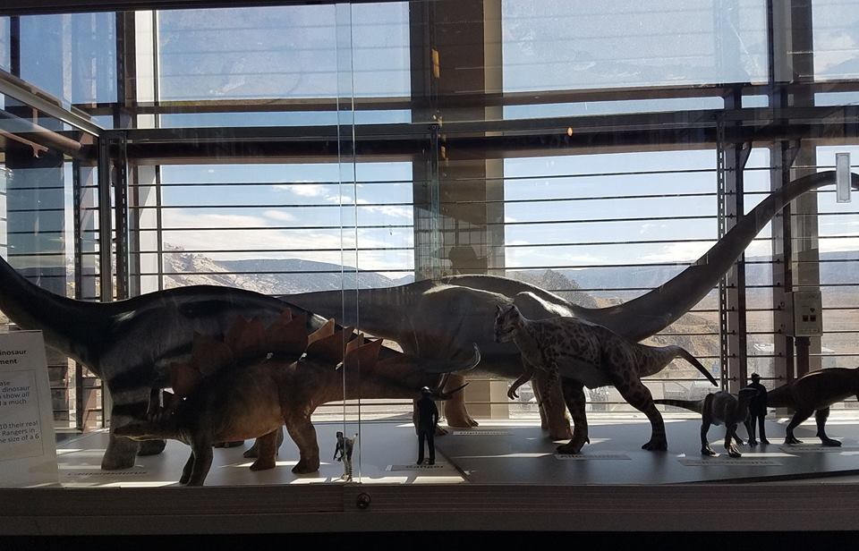
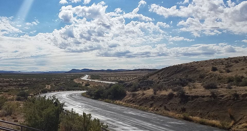
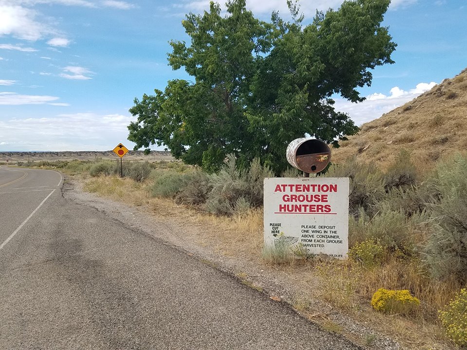
The first picture is Alex in front of the dinosaur quarry wall, now enclosed and protected. Next is Alex in front of the model stegosaurus. It was nice to see his enthusiasm, only a little more concealed than when he first came here when he was only four years old. The third picture are model dinosaurs. Notice the model ranger to give perspective. Penultimate is the lonely and winding road. There is an amazing amount of space out here. Many stretches were you get no bars on your mobile phone. Last is a grouse wing collection spot. It is not mere morbid collecting. Researchers use the wings to study bird numbers and migration patterns.

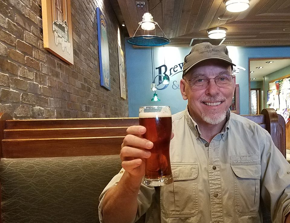
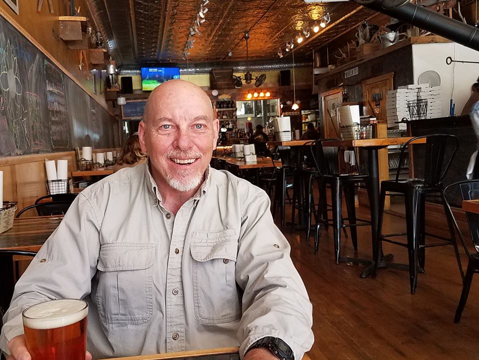
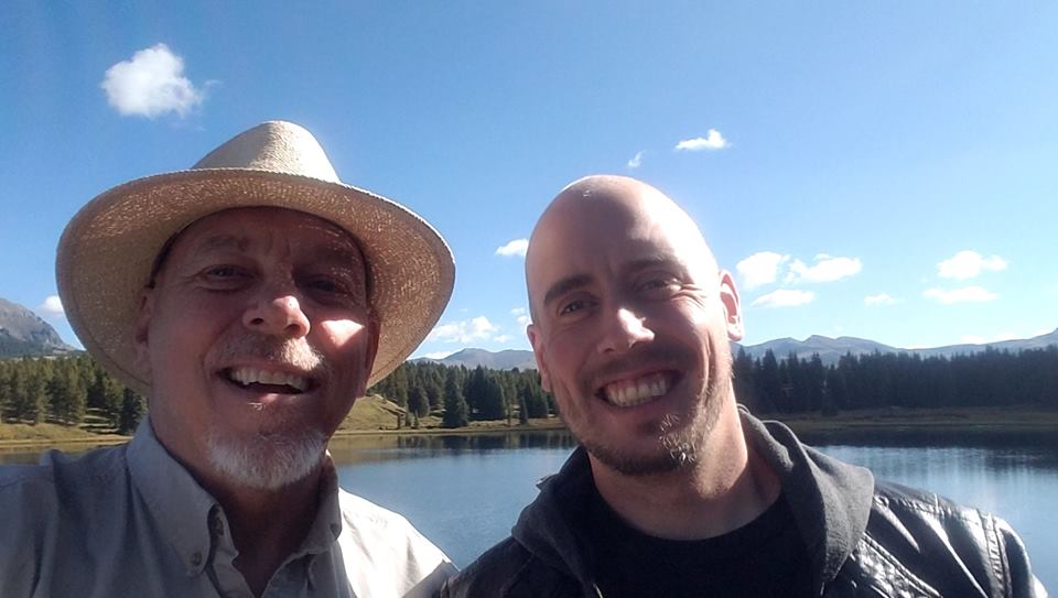
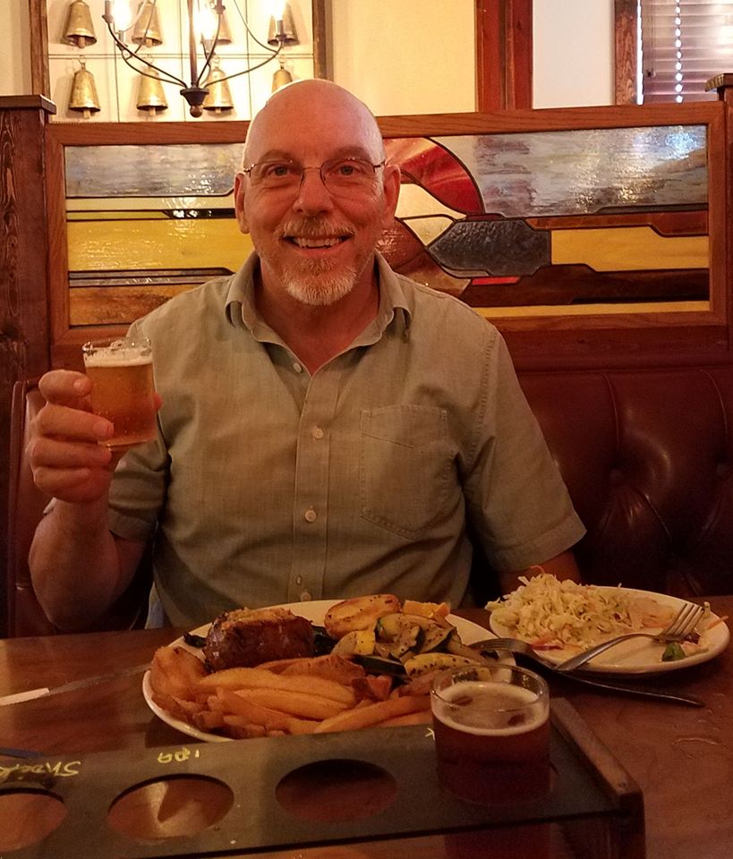
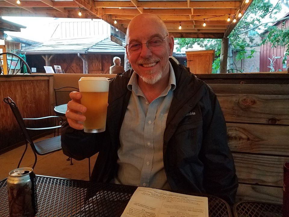
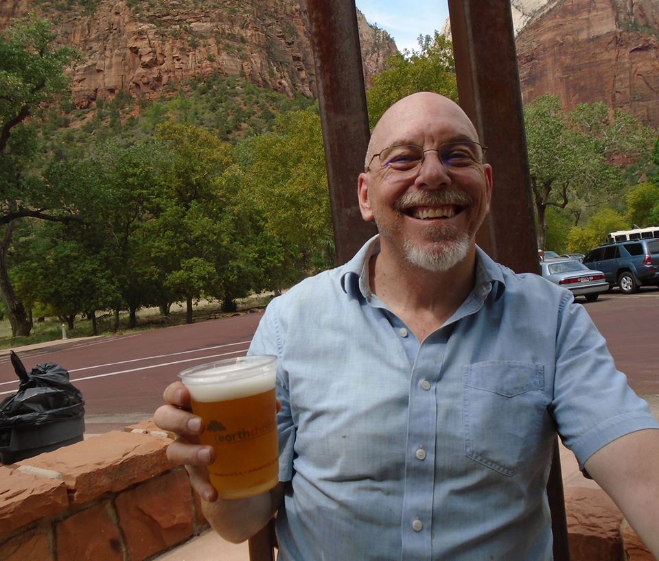
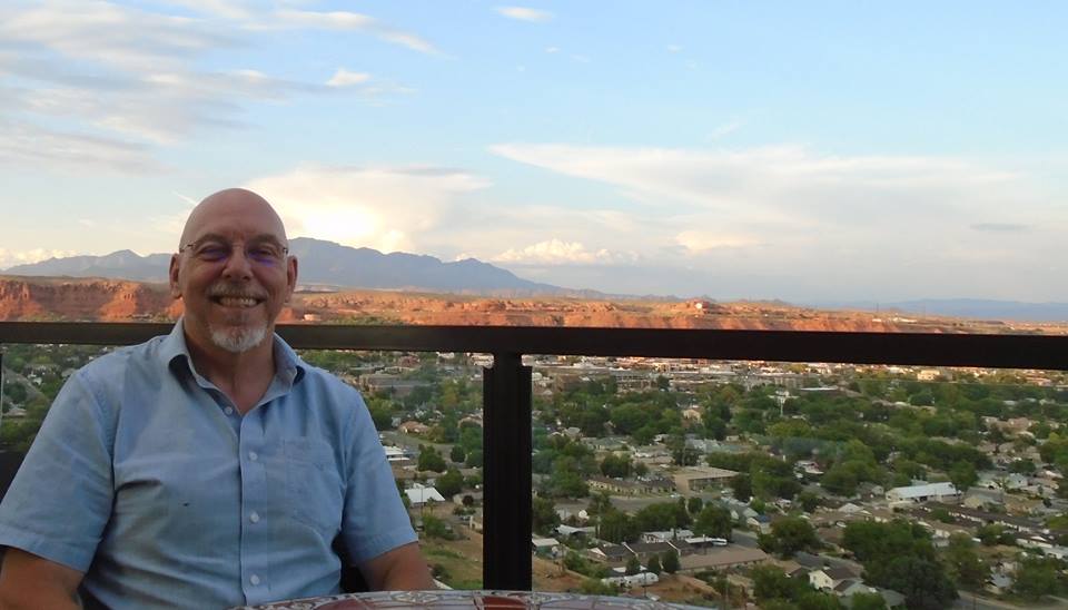
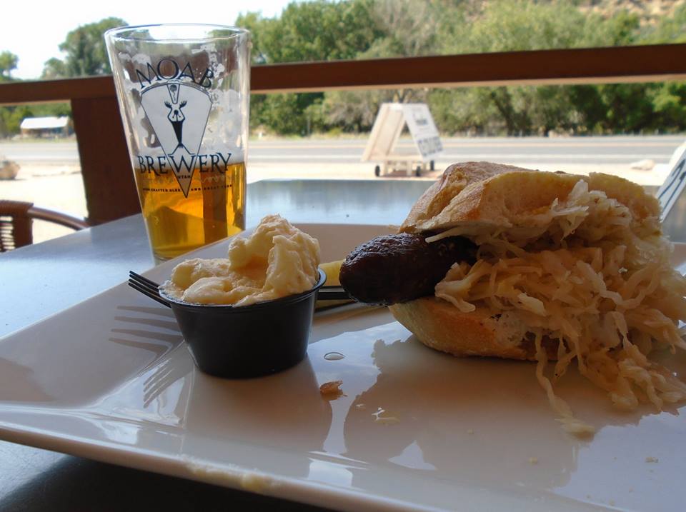
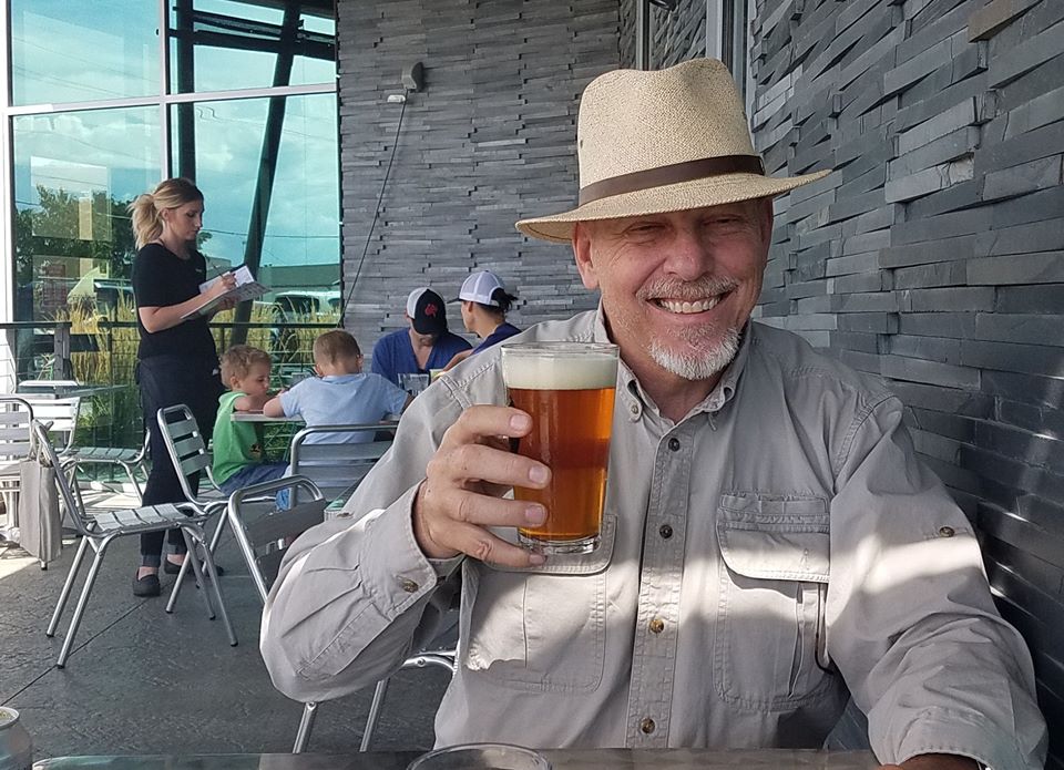
I thought maybe I would post the beer picture first this time rather than last of the day. This one was taken at the Vernal Brewery. Alex said that I merely have the same photo each time, so I changed it up by putting on my hat.

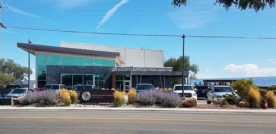
Vernal Brewery has a nice outdoor seating area and it is conveniently located across the street from the dinosaur museum. Alex and I went to the museum and then just walked over.

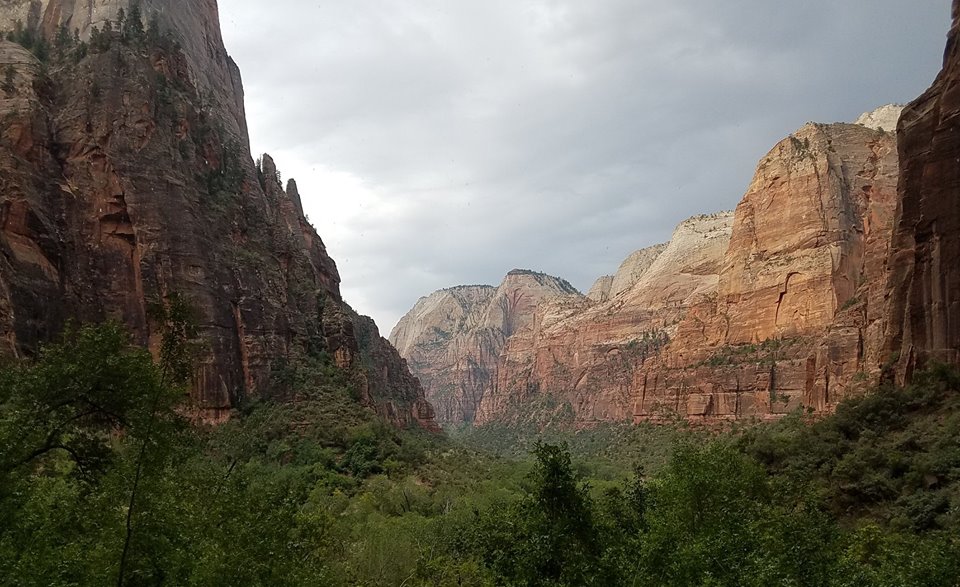
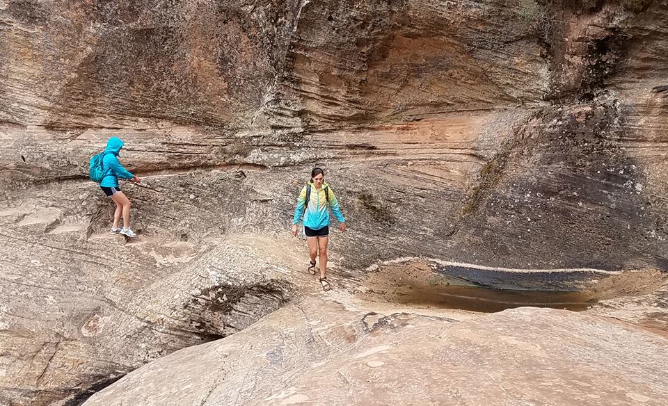
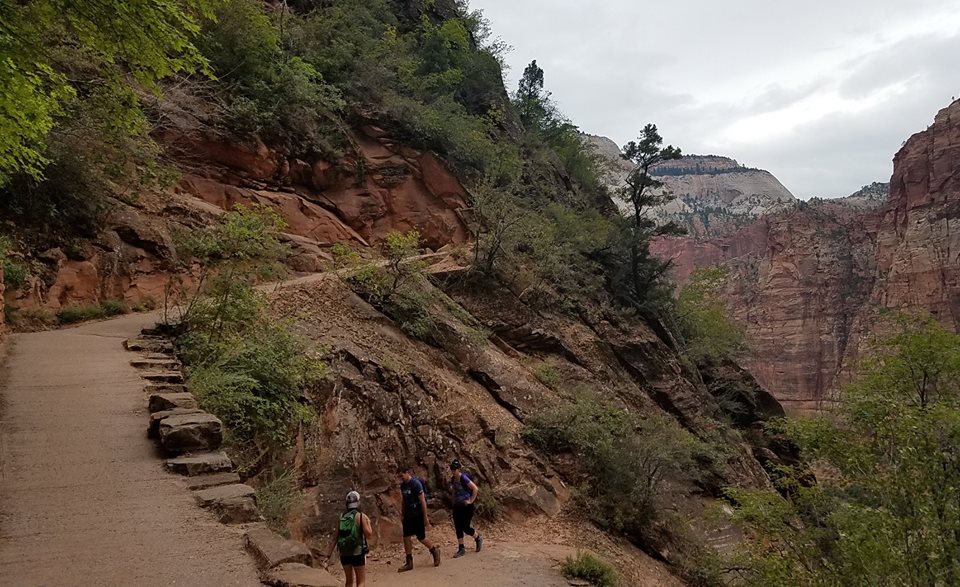
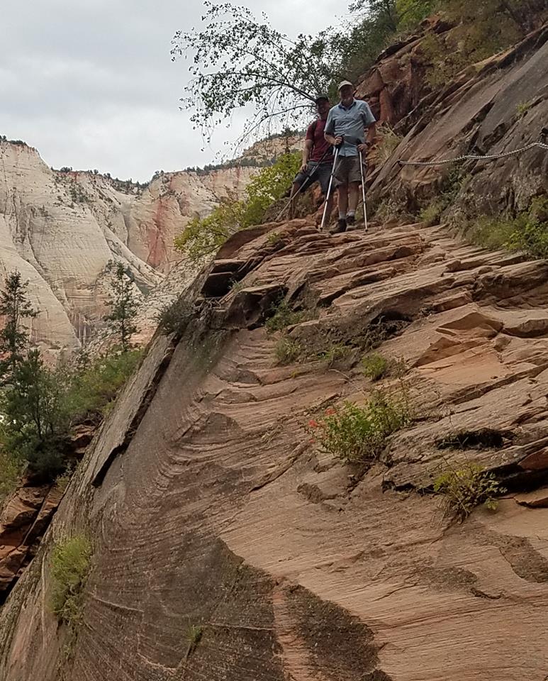
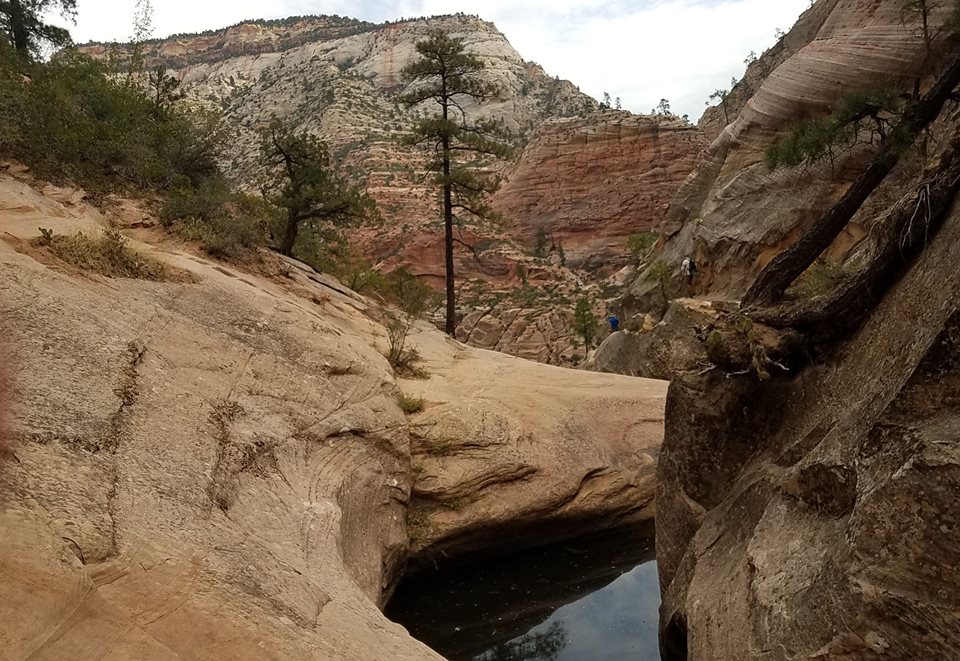
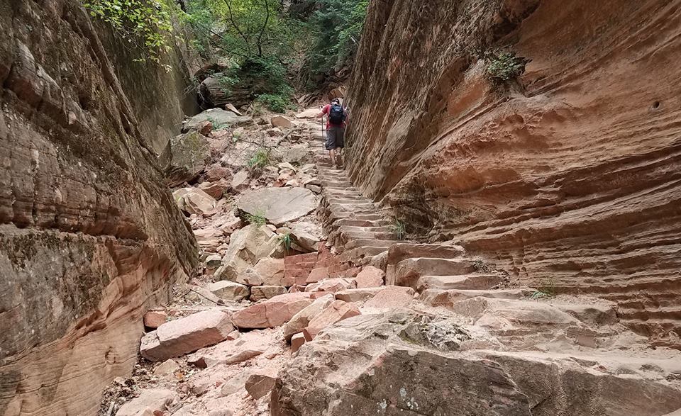
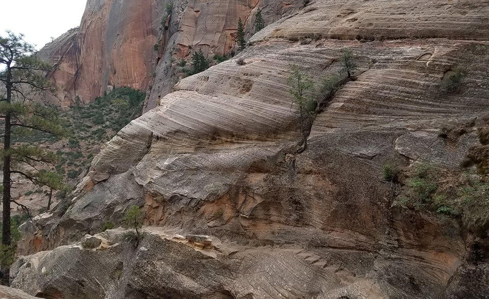
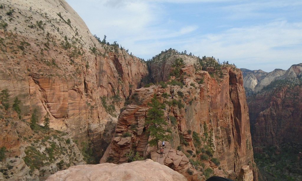
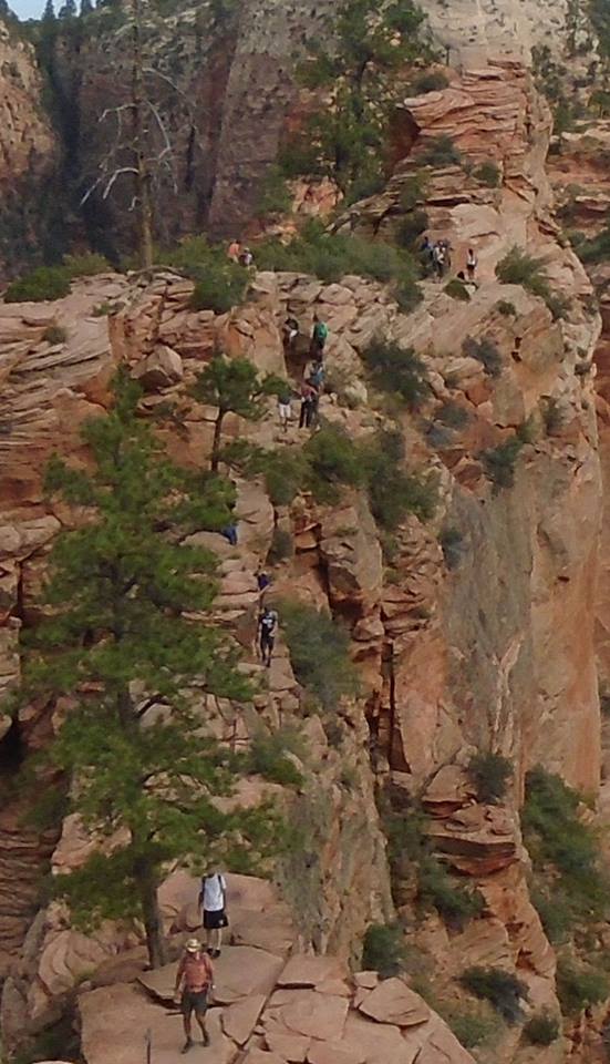
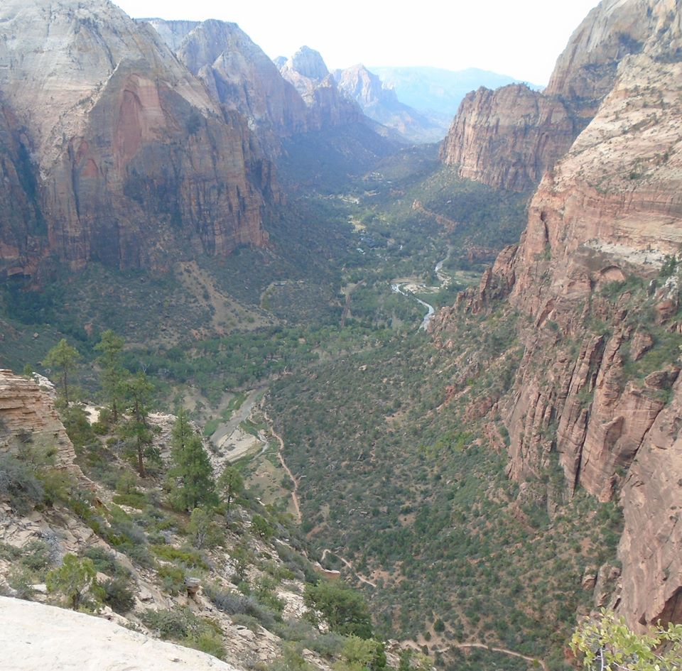
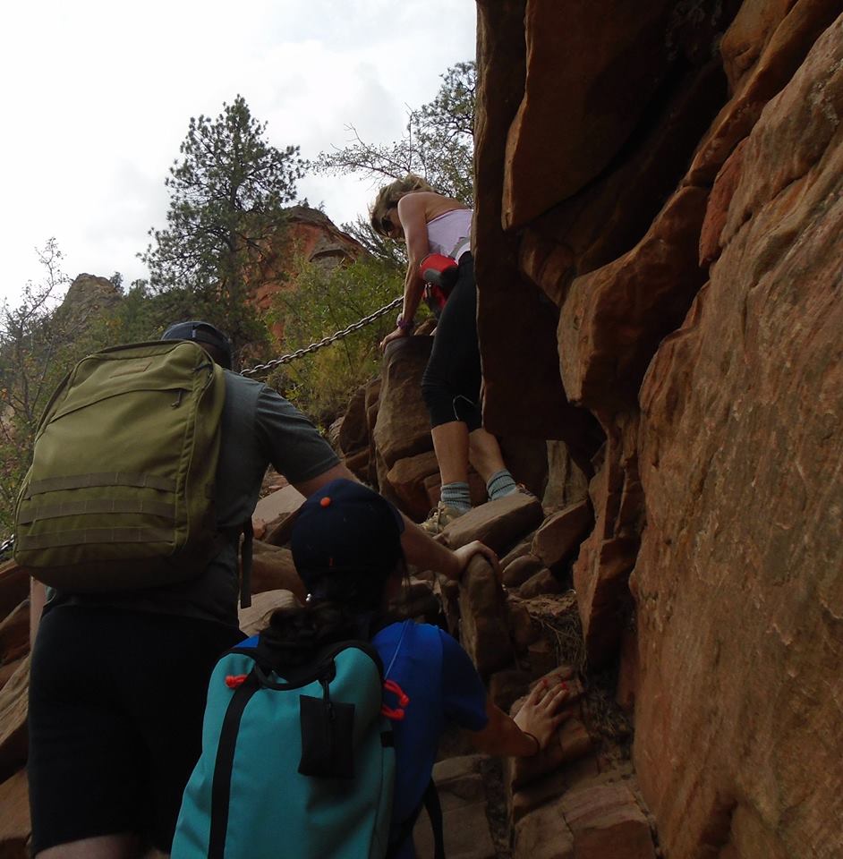
I have been enjoying my time with Alex and I am happy to think that he is enjoying his time with me. One of his friends was supposed to go along but dropped out because he could not get off from work. I feel bad for Alex, but it worked out better for me. My role on the trip would have been much more passive. I think it likely that I would avoided some of the more strenuous hikes, like the one to Angel’s Landing.

This is the second time Alex and I have been to the dinosaur places in Vernal. He does not remember well the first time in 1992, when the whole family drove from Spokane, Washington to Washington, DC between our assignments in Norway & Poland. FSOs get “home leave” to be reacquainted with our country. On our home leaves, we crossed the country going east from San Francisco to by train, from Seattle, Spokane & Phoenix by car. Now I have to do it on my own, but I still want to do it.

As I sat in the Vernal Brewery across from my adult son thinking of the boy so excited by the same dinosaurs that I could still see across the street, I felt acutely the passage of time. Looking down at my aging hand, I doubted I would ever pass this way again. This might be the last big hiking trip with Alex and we will certainly never again do a family cross country trip. Driving with three kids asking when we were going to get there was not fun at the time, but it is remembered better than it was lived.

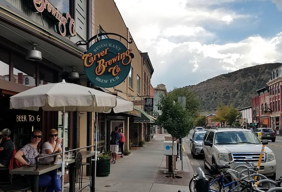
My first picture is my beer photo with the permutation of a hat. Next is Vernal Brewery. When you look at the building, one thought should enter your mind – it could have been built faster and better in the same form using cross laminated timber. That is what popped into my head.

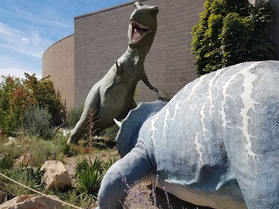
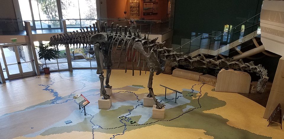
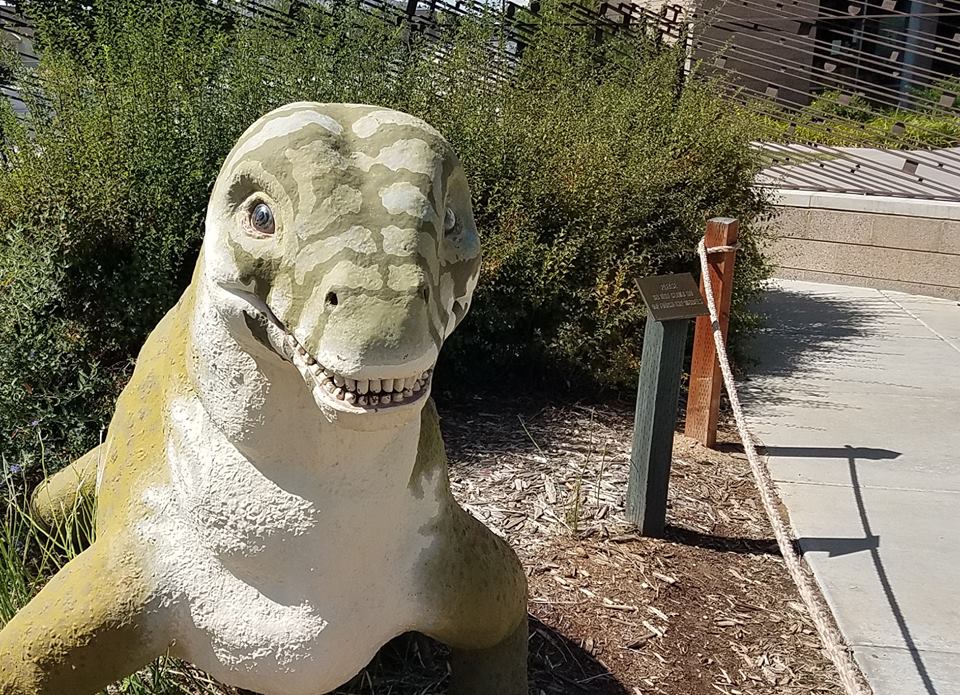
Number three the the traditional duel between triceratops and tyrannosaurus. It was standard fare for the dino myths of my childhood. Scientists now believe that such things never happened, that tyrannosaurus was colorfully feathered and that they didn’t walk around in that clumsy clipped kangaroo fashion. But besides that, it is accurate and it was the best science at the time. Next is a full skeleton of a long necked dinosaur. Finally is something called a “mochops”. I never heard of it before, but I appreciated the quizzical look on its face. I noticed that several of the animals depicted have looks like that. I think that is more the result of the artist than the science. Maybe he used his dog as a template.

Mesa Verde 2

My last pictures for the day. I am posting my relaxing photos. They are all the same, but in different places. This one is in Carver Brewery in Durango, Colorado. They have good beer that they make on the premises.

On the walk back, we passed Durango Distillery. They are only recently in business and have so far made moonshine, i.e. clear and not aged whisky and vodka. They are in process of making a Bourbon-like beverage. It was aging in white oak barrels, but will not be ready for another two years. I tried the products on offer and bought a bottle of “Mayday Moonshine,” which I will share and enjoy with Chrissy when I get home.

My first picture is me and beer. Next is the brew pub outside, followed by the Durango Distillery. Second last is from the visitor center at Mesa Verde. I thought it was sort of artistic. Last shows our guide for one of the ranger programs at Mesa Verde.

Travels in Colorado & days of fire past

Day’s end
My end of day post with my daily beer. This one was at Golden Block Brewery and Restaurant in Silverton, Colorado.
Chrissy pointed out that my beer pictures imply that I am a boozer. I do tend to drink beer almost every day, but I do not drink all day. I usually have no more than a couple beers, often have only one, and some sad days none at all. I like the “beer experience,” but I do not habitually pound down very many.

Fires of the past
I have been observing the ghosts of forest fires past during my trip. I mentioned the fire that destroyed the piñon pine-juniper ecosystem at Mesa Verde. I will put the link to that one in the comments section. It did not recover even after almost fifteen years.
Today I saw the effects of an even older fire. The Lime Creek fire destroyed 25,000 acres of spruce-fir forest way back in 1879. It has not recovered even now.
This is very different from the fire regimes in Virginia and the Southeast, where the forests begin to recover the next growing season and where many forests are actually fire dependent. I visited the site of the Peshtigo Fire that in 1871 was the largest fire in American history. Those forests have grew back through natural regeneration.

Location and the precise ecology is very important.
Look at the pictures and notice that the trees are in rows. People started to plant trees back in 1911 and the process is still continuing. I didn’t climb up to look, but it looks like there has been little natural regeneration in places not planted. Again, this is so different from what I observe in the rainier pine forests in the south and the lake states.


Quick moves among ecosystems

A remarkable thing about the west is how fast you can move among vastly different ecosystems. Yesterday, we were in the high desert. We went to the piñon pine-juniper ecology by midday and ended the day among the ponderosa montane forests. Today, we moved through the ponderosa and into the spruce-fir ecology, where these pictures are taken.

Ancestral Pueblo & fire on Mesa Verde

Mesa Verde
We went up from Chaco Canyon to Mesa Verde, the other big Anasazi place. This one was also abandoned around 1300. Scholars speculate about the reasons. Maybe it is simple as the lifestyle was just not sustainable.

We listened to an audio book called “Cities of the Ancient World” on the way to and from the Mesa Verde. Most of the great cities and cultures of the world have declined or disappeared. Our experience in the last couple of centuries is not the common one. We have experienced more or less steady growth. But even we have ghost towns, places abandoned when the resource played out or just when people found better opportunities.

Alex made a couple of good speculations. Maybe simple prosaic causes pushed them people out. This settlement was on the edge of a trading community. Maybe when centers farther south declined, this one did too. It is like the contagion of the economic decline of 2008. Or maybe they just used up the resource. The forests above Mesa Verde were destroyed by fire in 2003. They still have not recovered. A fire or a drought would starve the people of Mesa Verde. Theirs was always a precarious existence. It would not take much to tip them off.

Fire on Mesa Verde

Fires stopped us from visiting Mesa Verde when we drove through here back in 2003. Turns out that this was a serious fire, part of a series of fires that burned 24,000 acres in Mesa Verde in 2002-3. This land was covered with old growth juniper and piñon pine forests. These are slow growing trees that never get very tall. It is not a fire adapted forest. A big fire can kill it. A big fire did kill it – all of it.

As many reading this know, I am an advocate of using fire in forestry. I have used fire on my own land with excellent results. It is a wonderful but fierce tool and fire is not appropriate in all conditions. I walked through some of the burned over acres today. After around fifteen years, the land still has not recovered. It is so different from what I know in Virginia. There is no evidence of natural regeneration, even near places where the forest is intact and presumably living trees would have provided seeds.

What to do? If you believe in “natural” you do nothing and let nature decide. This is not good. Nature doesn’t do any thinking. Random events can create widely divergent outcomes. A confluence of good conditions might restore the forest, while bad luck will leave it in the poor state it is today. And bad luck is much more likely.

Piñon, for example, don’t produce germinating seeds until they are 75 years old. And when they do produce, they only produce viable seeds only every seven to eight years. If they hit a drought during that time, nothing grows.

Right now, the ground is covered with invasive cheat grass and in lots of places with nothing at all. It seems that there is kind of an ecological Nash equilibrium. This calls for human intervention to move it off this self-sustaining bad outcome.

There would be a question of resources, but it would be useful to replant pines and junipers. Once established, they would be sustainable, at least until the next big fire.
There really is no natural choice. There are many options, some better than others. There has been no human-free environment in North America for at least 12,000 years. The fires that destroyed the piñon -juniper forest was human-made. At least part of it was caused by the Ips beetle killing piñon pines. The beetle probably hitchhiked in on a car or truck. The cheat grass is an invasive brought in by humans. Humans started some of the fires. Given all these human choices that created this outcome, it is silly – it is pernicious – to think that there is a natural choice. There are, however, sustainable choices that can be had with a targeted human intervention.

Ancient America

Alex and I climbed up to the ridge to get a better view of the valley. You have a fairly arduous climb through a notch, as you see in the first picture and then it is mostly flat. The next picture shows the valley from the ridge, followed by the ruins from the height. Picture #3 shows a butte followed by a kiva, a ceremonial room of the Ancestral Pueblo.

Settlements flourished in Chaco Canyon from around AD 800-1250. Then the people left. Nobody is sure why. Some speculate that climate change was the culprit. It got hotter and dryer around 1250. Others say it might have been warfare. There is evidence of violence and maybe even cannibalism near the end of the period, but there is no genaral agreement among scholars. For whatever reason, the people dispersed.

The structures of Chaco fell into ruins and filled with windblown dirt. The Navajo avoided the ruins, considering them full of evil spirits. A U.S. cavalry detachment came across the place in 1849. Most of the names of the structures date from that time. The cavalry had a Mexican scout. When asked about the ruins, he just gave them Spanish names. Chaco Canyon, for example, just means flat canyon. Pueblo Bonito, means pretty village, while Pueblo de Arroyo means village on the wash.

The structures were build in the shapes of D, oriented toward the cardinal directions. Scholars speculate that astronomy was very important to the inhabitants.They carefully watched the solstices and the equinox. At the winter solstice, they did elaborate ceremonies to coax the sun back. Seems to have worked, at least from their point of view.

My first two pictures shoe Pueblo Bonito and Pueblo de Arroyo.

The structures are made from stacked stone, with outer layers shaped to fit together with little mortar. Inside was filled with coarser stone and rubble. You can see an example in the third picture. The roofs were made from wood. Ponderosa pine timbers formed the supports were carried from far away. The nearest pine forests are sixty miles away. The forth picture shows the mass timber construction.

I learned another part of my knowledge has been overtaken by events on our visit to Chaco Canyon. I learned that it had be built by people called the Anasazi. Today I learned that they are the people formerly known as the Anasazi, now called “Ancestral Pueblos”.

Seems that the name Anasazi is pejorative. It was the name that the Navajo gave them and it means ancestors of the enemy, i.e. the Pueblo. (The Navajo and the Pueblo did not get on well. The Navajo are more recent invaders from the north and displaced the original people to a great extent.) Of course, I am not sure that Ancestral Pueblo is a much better term, since the nobody is really sure about the details of the Anasazi. Maybe better stick with the old name.

No matter the names, Chaco Canyon is interesting. It is hard to get here. It is near nothing and you have to drive for a half hour on a dirt road flanked by open range, so the cows wander across, as you see in the pictures below. I will write more about the Chaco experience in a few minutes.

My first picture shows livestock on the road, followed by a picture of the sign warning of the cows. Third is a nice of picture of the sky and one of the windows. Finally, shows a gap in the hills through which a the Anasazi built roads.

Utah & New Mexico with Alex

Glen Canyon
We went over Glen Canyon Dam. It is about as tall as Hoover Dam, but a lot narrower and impounds less water.

First is the Colorado River below the dam, next the dam and the river above. Last three are from the dirt road that we took to Buckskin Canyon. The colors and contrasts are very bright here. Alex pointed out that blue and orange contrast on the color wheel, since lots of the ground is reddish-orange it sets off strongly from the blue skies.

Buckskin Canyon
We hiked down and through Buckskin Canyon. This is an iconic slot canyon often featured in magazines. It is an easy hike except for one place where a big rock has blocked the way. The canyon is very narrow and you can understand how a flash flood would be deadly, but we had blue skies and little sign of water in general.

Farmington
Latest in our travel: beer drinking, filling up with gas at Sinclair and eating at Porter’s Smokehouse. We had a couple of flights of beer, which is why the cups are so small. You can see me, Sinclair, Porter’s Restaurant and Alex in the wash on the way to Buckskin Canyon.

Utah Sep2017

Alex & I walked down to the Iron Horse restaurant. It had a good outdoor place to eat and drink and keeping with my natural beer garden environment, I felt right at home. I had the Ghost Rider IPA by Wasatch Brewery.

But I was lured off the patio and inside the restaurant by good country music. This guy played all the old songs I liked. Alex tolerated them, but knew none. I bought the guy’s CD. I think I have a CD player, but I made the purchase more out of solidarity than desire to have a CD.

They asked for requests and played two of mine: “Ghost Riders in the Sky” & “El Paso.” They didn’t do my other request: “Where the Mountains Meet the Sky.” Maybe they didn’t know it. Not many people do these days.

Kanab is an interesting little town. It used to be a bigger deal for movie making and there are lots of pictures of old timey actors. I knew most of them by their faces and some even by their names. Alex knew none except John Wayne.

They named the steaks at the Iron Horse, and named one for the Duke. The John Wayne steak is 36 ounce rib eye. If you eat the whole thing, you got to be in the John Wayne club. It seems to me that if you win you lose and if you lose you lose, so better not to play that game at all. Alex had the Joel McCrea steak. Said it was good. I just went with pulled pork.


The ranger laughed when he saw the mud on our car. He knew that the GPS has directed us down the dirt road. It doesn’t usually rain much around here, but it rained this morning and made it muddy. There was a paved road. It was a little longer. We took that one on the way out.

It was an atypical day at Coral Pink Dunes, cool and with drizzling rain. I imagine it must be a different experience with hot sun. I liked the day we got.

The sand moves too much for plant roots to take hold on most of the dunes. They are the classic shifting sands. But Some have vegetation that holds them in place. Where there is enough stability and water, they even get trees. You can see all sorts of dunes on the first picture, moving sand, brush and trees. We had some low clouds that added to the experience, as you see in the second & third pictures. Forth is a hummock. The roots grab the sand on the leeward side and catches more sand. As the roots are buried, they reach farther down and can access water more easily.If it gets stable enough, it can be colonized by gambel oaks. Last picture is Alex trying to look like an explorer.

Zion and Hidden Canyon

We had wonderful weather today, cool in the morning and only about 85 (low humidity) by the afternoon.

We got some rain, which meant that we could not walk much up the narrows canyon through the water, for fear of flash floods. I didn’t want to do this anyway. I don’t think it is much fun to slosh through water and soak my boots. I admit that I used the threat of flash flood as an excuse, but the authorities do warn against this.

We walked up the path to hidden canyon. This canyon remained hidden until somebody fell in and discovered it. It was a pretty walk and not very hard or scary, but there were some tight ledges.

You can see us on the trails. I have included a video of the weeping rock. Water falls on the plateau above, seeps through the permeable sand and rock until it hits impermeable “aquicludes” and it drips out.

Angels' Landing in Zion National Park

Alex and I climbed to “Angel’s Landing” in Zion. It was not a very long hike, but it is steep, arduous & scary. When you get near the top, it is impossible to climb safely w/o the help of chains anchored to the living rock. At some point there is drop off of hundreds of feet on both sides of a narrow causeway.

The pictures I took do not show the reality. I am not naturally afraid of heights, but I felt a little dizzy sometimes and held fast to the chains at all times.

A lot of people climb up. It takes almost an hour to climb down from the rocks to the ordinary trail, as you have to take turns and wait for people coming up, and you are packed in. It is like when they are doing road construction and traffic can move only one way. We had some pretty French girls in front of us and some nice looking American girls behind.
We were talking to the girls at one of the stops. One of them pointed out that I was an inspiration to the people coming the other way. I felt proud until she continued that the oncoming folks would feel encourage that if an old guy like me could make it, they could too. She quickly realized that she had inadvertently told the truth and tried to dissemble, but I told her that she was right.

As I said, the pictures do not do it justice. I suggest that you Google a video of “Angel’s Landing.” The video shows it better. The trail has two summits. You get up to “Scout’s Landing” and then you climb some chains and you think you are almost to the top. When you get to the top, you see there is much more, as you can see in the first photos.

Around Utah

German bakery in the high desert
Had lunch at a German bakery. They had a nice set up. We had brats and beer. Just like Germany, except different geography, drier conditions, much lower population density …

Fixing the tire
We got a slow leak on one of the tires. Lucky we found a place to fix it. You can see the shop waiting area with the big elk. The guys evidently liked hunting. The waiting area featured lots of mule deer, a pronghorn and a bighorn sheep.

Desert rain
After visiting Bryce Canyon, we had a short but very intense summer rain storm. It was over in about ten minutes and dried out right after. There are also a few more photos of the canyon.

Beer belongs

I like to think of my “natural environment” as the forests and fields, but I think it might actually beer gardens.

As long as I am in Utah & Colorado, I think I will transfer my allegiance from Love’s to Sinclair. I have three good reasons. First, I like the dinosaur logo. Second, when I was a kid, there was a Sinclair station on Howell Avenue near my house. Third, there don’t seem to be many/any Love’s around here.

Good mileage
I have been getting very good gas mileage for the SUV around here. Maybe it is the “dinocare” from Sinclair. More likely, it is because I am driving on good highways, but at lower and more efficient speed.

Alex and I climbed to “Angel’s Landing” in Zion. It was not a very long hike, but it is steep, arduous & scary. When you get near the top, it is impossible to climb safely w/o the help of chains anchored to the living rock. At some point there is drop off of hundreds of feet on both sides of a narrow causeway.

Angel landing
The pictures I took do not show the reality. I am not naturally afraid of heights, but I felt a little dizzy sometimes and held fast to the chains at all times.


A lot of people climb up. It takes almost an hour to climb down from the rocks to the ordinary trail, as you have to take turns and wait for people coming up, and you are packed in. It is like when they are doing road construction and traffic can move only one way. We had some pretty French girls in front of us and some nice looking American girls behind.

We were talking to the girls at one of the stops. One of them pointed out that I was an inspiration to the people coming the other way. I felt proud until she continued that the oncoming folks would feel encourage that if an old guy like me could make it, they could too. She quickly realized that she had inadvertently told the truth and tried to dissemble, but I told her that she was right.

As I said, the pictures do not do it justice. I suggest that you Google a video of “Angel’s Landing.” The video shows it better. The trail has two summits. You get up to “Scout’s Landing” and then you climb some chains and you think you are almost to the top. When you get to the top, you see there is much more, as you can see in the first photos.

Last pictures. First is Alex and I near the top of the Angel’s Landing climb. Next is a monument to the CCC boys, who did a lot of work in Zion. After that is Alex’s supper and finally the beer menu. Evidently, beer can be only 4% alcohol in Utah.